Cheyenne Mtn
| Site Name: | Cheyenne Mtn | 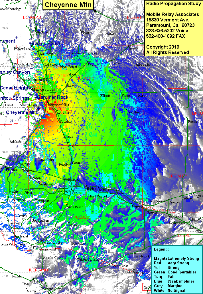 Cheyenne Mtn Coverage |
| Latitude: | 038 44 37.9N | 38.7438611 |
| Longitude: | 104 51 46.2W | -104.8628333 |
| Feet | Meters | |
| Ground Elevation: | 9,459.0 | 2,883.1 |
| HAAT: | 2,167.5 | 660.7 |
| City: | Colorado Springs | |
| County: | El Paso | |
| State: | Colorado |
This is not an MRA Owned Site. For space rental contact the site owner.
Do you own or manage this site? Click Here
Would you like to add a site to the Google Earth Map?? Click Here
Site Coverage: Coverage of Colorado Springs, Pueblo, Bragdon, Portland, Penrose, Wetmore, Vineland, Eastonville, La Foret, Monument