Colorado Springs
| Site Name: | Colorado Springs | 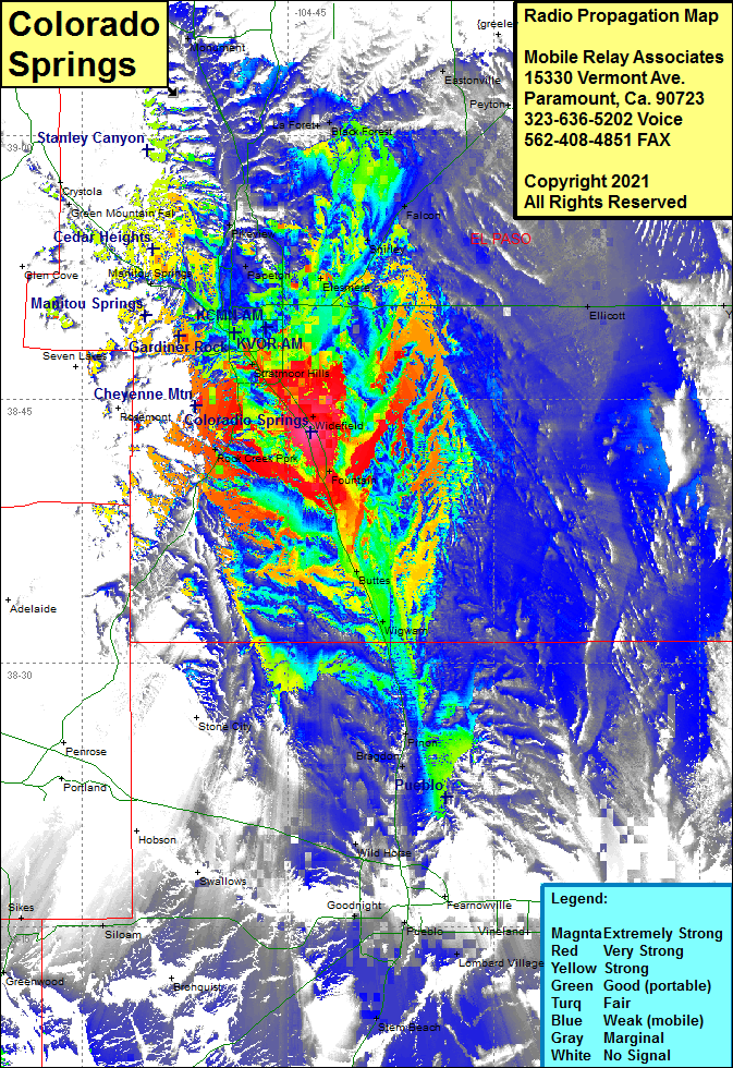 Colorado Springs Coverage |
| Latitude: | 038 43 10.8N | 38.7196667 |
| Longitude: | 104 43 19.5W | -104.7220833 |
| Feet | Meters | |
| Ground Elevation: | 5636.0 | 1717.9 |
| HAAT: | 12.5 | 3.8 |
| City: | Colorado Springs | |
| County: | El Paso | |
| State: | Colorado |
This is not an MRA Owned Site. For space rental contact the site owner.
Do you own or manage this site? Click Here
Would you like to add a site to the Google Earth Map?? Click Here
Site Coverage: Coverage of Colorado Springs, Kelker, Knob Hill, Stratton Meadows, Ivywild, Broadmoor, Stratmoor Hills, Skinners, Security, Widefield, Fountain, Rock Creek Park, Elesmere, Papeton, Rosewll, Manitou Springs, Glen Eyie, Trail Junction, Green Mountain Fal, Monument, Pikeview, La Foret, Black Forest, Shirley, Falcon, Eastonville, Palmer Lake, Glen Park, Eastonville, Peyton, Yoder, Elicott, Fountain, Buttes, Wigwam, Henkel, Pinon, Bragdon, Eden, Wild Horse, Goodnight, Salt Creek, Blende, Lombard Village, Vineland, Marnel, Stem Beach