Copper Mtn II
| Site Name: | Copper Mtn II | 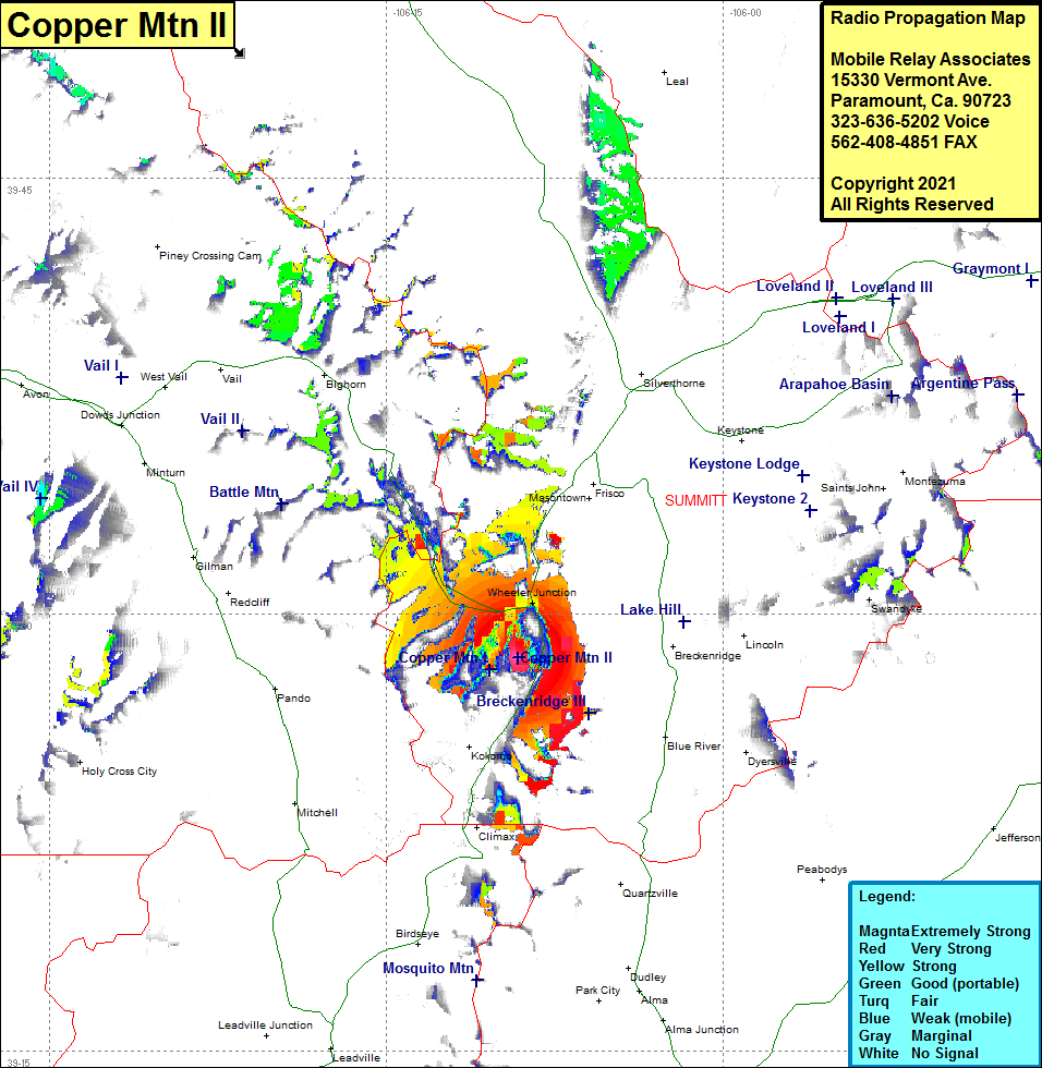 Copper Mtn II Coverage |
| Latitude: | 039 28 30.9N | 39.4752500 |
| Longitude: | 106 09 08.2W | -106.1522778 |
| Feet | Meters | |
| Ground Elevation: | 12048.0 | 3672.2 |
| HAAT: | 1058.0 | 322.5 |
| City: | KoKomo | |
| County: | Summit | |
| State: | Colorado |
This is not an MRA Owned Site. For space rental contact the site owner.
Do you own or manage this site? Click Here
Would you like to add a site to the Google Earth Map?? Click Here
Site Coverage: Coverage of Wheeler Junction, Copper Mtn Ski Area, Interstate I70 from just west of Frisco to 9 miles northwest of Copper Mountain, Colorado Highway 90 from Wheeler Junction heading south to the Mayflower Tailings Pond