Craig
| Site Name: | Craig | 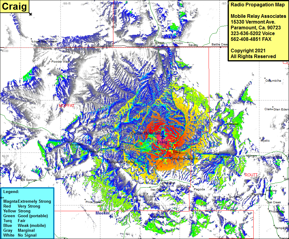 Craig Coverage |
| Latitude: | 040 33 55.6N | 40.5654444 |
| Longitude: | 107 36 41.9W | -107.6116389 |
| Feet | Meters | |
| Ground Elevation: | 7485.0 | 2281.4 |
| HAAT: | 969.9 | 295.6 |
| City: | Craig | |
| County: | Moffat | |
| State: | Colorado |
This is not an MRA Owned Site. For space rental contact the site owner.
Do you own or manage this site? Click Here
Would you like to add a site to the Google Earth Map?? Click Here
Site Coverage: Coverage of Craig, Craig South Highlands, Hayden, Bear River, Elkhead, Loyd, Axiel, Lay, Maybell, Sunbeam, US Highway 40 heading east-west through Craig, Colorado Highway 13 heading north from Craig for 25 miles