Doghouse Mtn
| Site Name: | Doghouse Mtn | 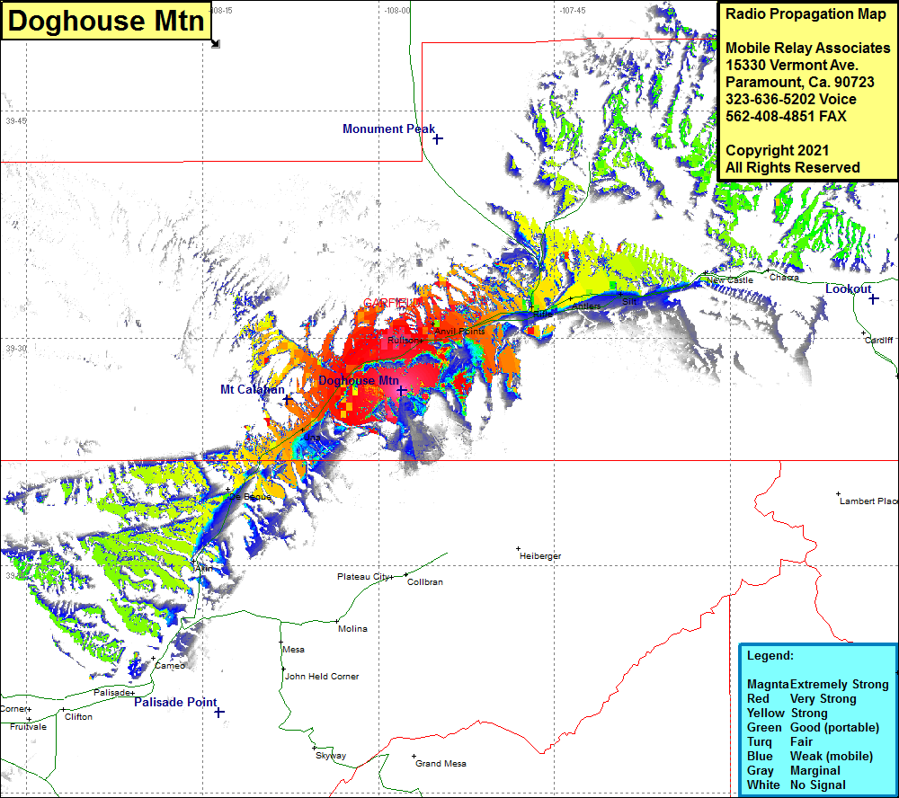 Doghouse Mtn Coverage |
| Latitude: | 039 26 32.8N | 39.4424444 |
| Longitude: | 107 58 03.3W | -107.9675833 |
| Feet | Meters | |
| Ground Elevation: | 7279.0 | 2218.6 |
| HAAT: | -12.0 | -3.7 |
| City: | Parachutte | |
| County: | Garfield | |
| State: | Colorado |
This is not an MRA Owned Site. For space rental contact the site owner.
Do you own or manage this site? Click Here
Would you like to add a site to the Google Earth Map?? Click Here
Site Coverage: Coverage of Rulison, Anvil Points, Rifle, Antlers, Silt, New Castle, Una, De Beque, Akin