Simla Tower
| Site Name: | Simla Tower | 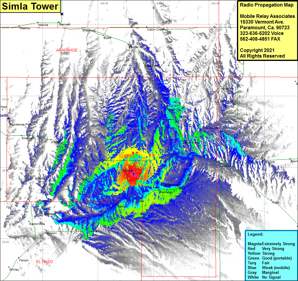 Simla Tower Coverage |
| Latitude: | 039 13 35.8N | 39.2266111 |
| Longitude: | 104 05 23.9W | -104.0899722 |
| Feet | Meters | |
| Ground Elevation: | 6170.0 | 1880.6 |
| HAAT: | 311.3 | 94.9 |
| City: | Simla | |
| County: | Elbert | |
| State: | Colorado |
This is not an MRA Owned Site. For space rental contact the site owner.
Do you own or manage this site? Click Here
Would you like to add a site to the Google Earth Map?? Click Here
Site Coverage: Coverage of Peoria, Deer Trail, Agate, Cedar Point, Limon, Genoa, Alta Vista, Matheson, Simla, Ramah, Calhan, Peyton, Fondis, Elbert, Bijou