Flat Top Mtn
| Site Name: | Flat Top Mtn | 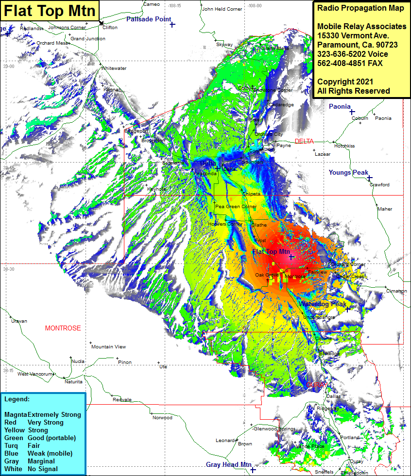 Flat Top Mtn Coverage |
| Latitude: | 038 31 00.6N | 38.5168333 |
| Longitude: | 107 51 09.0W | -107.8525000 |
| Feet | Meters | |
| Ground Elevation: | 6311.0 | 1923.6 |
| HAAT: | 84.8 | 25.9 |
| City: | Montrose | |
| County: | Montrose | |
| State: | Colorado |
This is not an MRA Owned Site. For space rental contact the site owner.
Do you own or manage this site? Click Here
Would you like to add a site to the Google Earth Map?? Click Here
Site Coverage: Coverage of Oak Grove, Montrose, Fairview, Luane, Orchard Corner, Cimarron, Uncompahgre, Colona, Eldredge, Frost, Olathe, Hoovers Corner, Pea Green Corner, Chipeta, Delta, North Delta, Saunders, Cory, Austin, Payne, Orchard City, Eckert, Cedaredge, Bimstone Corner, Colby, Grand Mesa, Roubideau, Escalante, Keyhole, Broughton, Bridgeport, Kannah