Ft Morgan I
| Site Name: | Ft Morgan I | 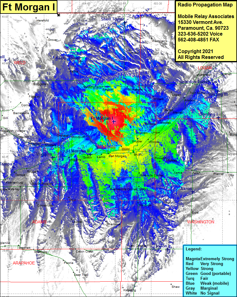 Ft Morgan I Coverage |
| Latitude: | 040 25 14.4N | 40.4206667 |
| Longitude: | 103 45 39.5W | -103.7609722 |
| Feet | Meters | |
| Ground Elevation: | 4766.0 | 1452.7 |
| HAAT: | 399.0 | 121.6 |
| City: | Ft Morgan | |
| County: | Morgan | |
| State: | Colorado |
This is not an MRA Owned Site. For space rental contact the site owner.
Do you own or manage this site? Click Here
Would you like to add a site to the Google Earth Map?? Click Here
Site Coverage: Coverage of Stoneham, Willard, Avalo, Fort Morgan, Nelson, Brush, Snyder, Cooper, Hillrose, Union, Balzac, Messex, Beta, Merino, Atwood, Logan, Hayford, Jessica, Padroni, Buchanan, Iliff, Galien, Twin Mills, Burdette, Pinneo, Midway, Xenia, Akron, Platner, Otis, Rago, Woodrow, Gary, Ninemile Corner, Twelvemile Corner, Leader, Hoyt, Comanche, Griffin, Weldona, Goodrich, Orchard, Roggen, South Roggen, Tampa, Keenesburg, Roy, Prospect Valley, Sheehan, Keenesburg, Masters, Canton, Hardin, Kuner, Kersey, Briggsdale, Purcell, Keota, Buckingham, Raymer, Dodd