Gardnier Rock
| Site Name: | Gardnier Rock | 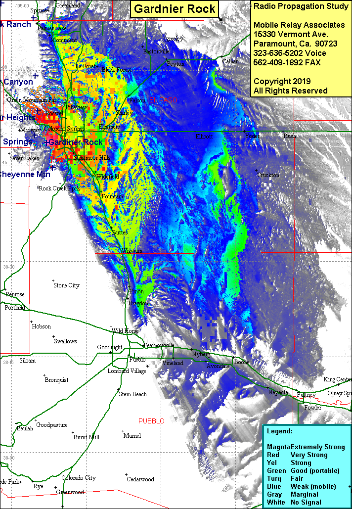 Gardnier Rock Coverage |
| Latitude: | 038 48 36.6N | 38.8101667 |
| Longitude: | 104 52 56.0W | -104.8822222 |
| Feet | Meters | |
| Ground Elevation: | 7,185.0 | 2,190.0 |
| HAAT: | -440.0 | -134.1 |
| City: | Colorado Springs | |
| County: | El Paso | |
| State: | Colorado |
This is not an MRA Owned Site. For space rental contact the site owner.
Do you own or manage this site? Click Here
Would you like to add a site to the Google Earth Map?? Click Here
Site Coverage: Coverage of the Colorado Springs, south to Wigwam and Hankel, east to Ellicott, north to Monument