Glenwood
| Site Name: | Glenwood | 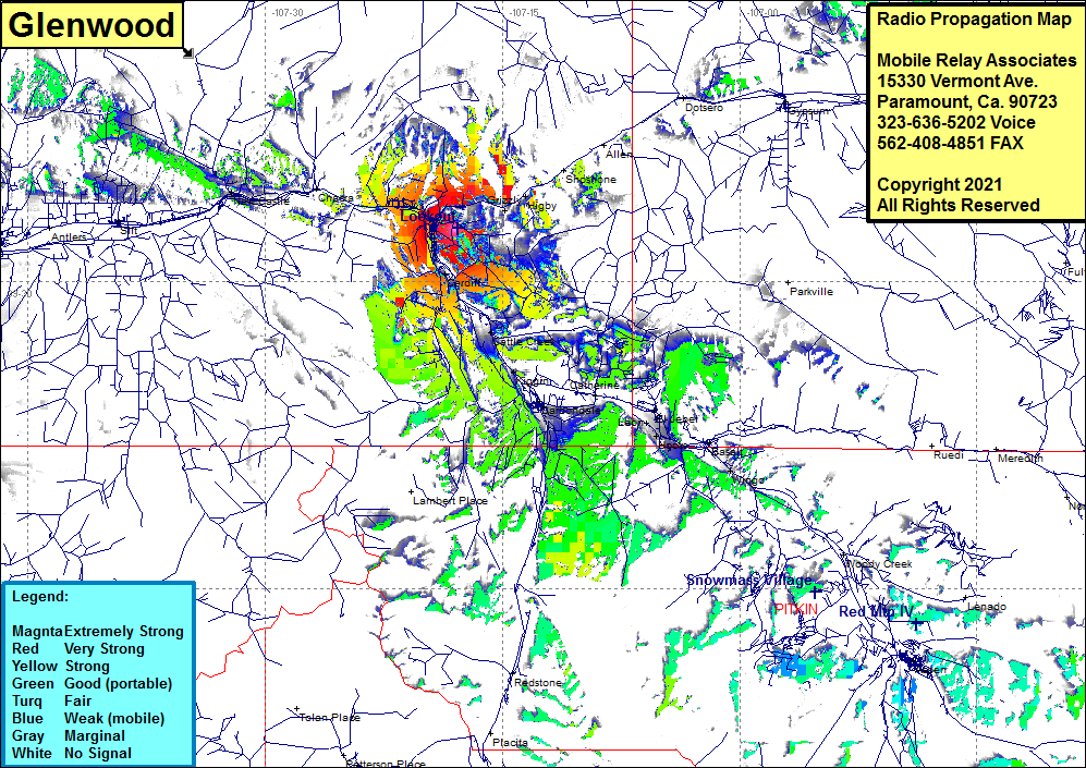 Glenwood Coverage |
| Latitude: | 039 32 34.3N | 39.5428611 |
| Longitude: | 107 18 00.1W | -107.3000278 |
| Feet | Meters | |
| Ground Elevation: | 7959.0 | 2425.9 |
| HAAT: | 74.9 | 22.8 |
| City: | Glenwood Springs | |
| County: | Garfield | |
| State: | Colorado |
This is not an MRA Owned Site. For space rental contact the site owner.
Do you own or manage this site? Click Here
Would you like to add a site to the Google Earth Map?? Click Here
Site Coverage: Coverage of Glenwood Springs, Grizzly, Higby, Shoshone, Cardiff, Funston, portion of Interstate I70, Cattle Creek, Cardiff, Kiggin