Gray Head Mtn
| Site Name: | Gray Head Mtn | 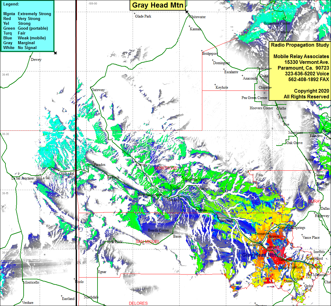 Gray Head Mtn Coverage |
| Latitude: | 037 59 29.0N | 37.9913889 |
| Longitude: | 107 58 23.2W | -107.9731111 |
| Feet | Meters | |
| Ground Elevation: | 10981.0 | 3347.0 |
| HAAT: | 1483.9 | 452.3 |
| City: | Sawpit | |
| County: | San Miguel | |
| State: | Colorado |
This is not an MRA Owned Site. For space rental contact the site owner.
Do you own or manage this site? Click Here
Would you like to add a site to the Google Earth Map?? Click Here
Site Coverage: Coverage of Sawpit, Vannadium, Lime, Keystone, Vance Jct, San Miguel, Telluride, Pandora, Ames, Placeville, Leonard, Brown, Glenwood Springs, Sams, Noel, Norwood, Coventry, Redvale, Basin, Ute, Paradox, Bedrock,