Graymont II
| Site Name: | Graymont II | 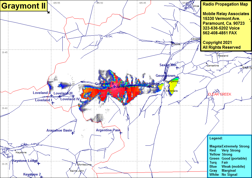 Graymont II Coverage |
| Latitude: | 039 41 41.4N | 39.6948333 |
| Longitude: | 105 47 39.2W | -105.7942222 |
| Feet | Meters | |
| Ground Elevation: | 9833.0 | 2997.1 |
| HAAT: | -1450.8 | -442.2 |
| City: | Graymont | |
| County: | Clear Creek | |
| State: | Colorado |
This is not an MRA Owned Site. For space rental contact the site owner.
Do you own or manage this site? Click Here
Would you like to add a site to the Google Earth Map?? Click Here
Site Coverage: Coverage of Graymont, Silver Plume, portions of Interstate I70 in the Graymont area