Guy Hill
| Site Name: | Guy Hill | 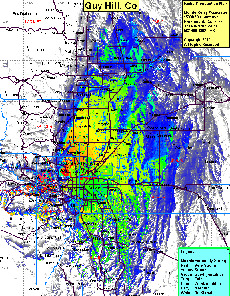 Guy Hill Coverage |
| Latitude: | 039 47 48.8N | 39.7968889 |
| Longitude: | 105 19 56.1W | -105.3322500 |
| Feet | Meters | |
| Ground Elevation: | 8378.9 | 2553.9 |
| HAAT: | 929.5 | 283.3 |
| City: | Golden | |
| County: | Jefferson | |
| State: | Colorado |
This is not an MRA Owned Site. For space rental contact the site owner.
Do you own or manage this site? Click Here
Would you like to add a site to the Google Earth Map?? Click Here
Site Coverage: Coverage of the Denver area of the front range south to Castle Rock and north to Galeton & Pierce, Golden, Smith Hill, Central City, Rullell Gulch, Black Eagle Mill, Freeland, Hidden Valley, Herzman Mesa, Marshdale, Evergreen, Sprucedale, Conifer, Fenders, Twin Forks, Indian Hills