Hell Creek
| Site Name: | Hell Creek | 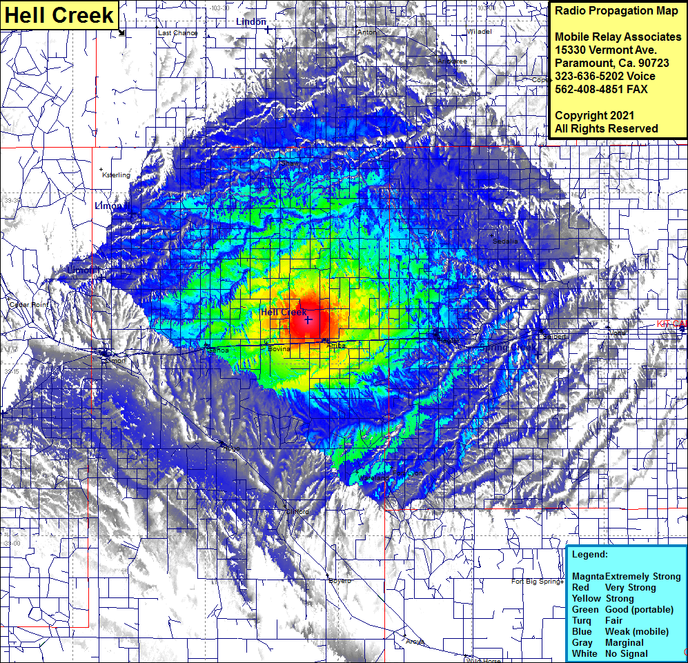 Hell Creek Coverage |
| Latitude: | 039 18 51.7N | 39.3143611 |
| Longitude: | 103 18 23.8W | -103.3066111 |
| Feet | Meters | |
| Ground Elevation: | 5285.0 | 1610.9 |
| HAAT: | 241.8 | 73.7 |
| City: | Arriba | |
| County: | Lincoln | |
| State: | Colorado |
This is not an MRA Owned Site. For space rental contact the site owner.
Do you own or manage this site? Click Here
Would you like to add a site to the Google Earth Map?? Click Here
Site Coverage: Coverage of Shaw, Anton, Arickaree, Wiladel, Cope, Sedalia, Seibert, Vona, Flagler, Fort Lyon, Wareland, Clifford, Hugo, Limon, Genoa, Bovina, Arriba