Horsetooth Mtn
| Site Name: | Horsetooth Mtn | 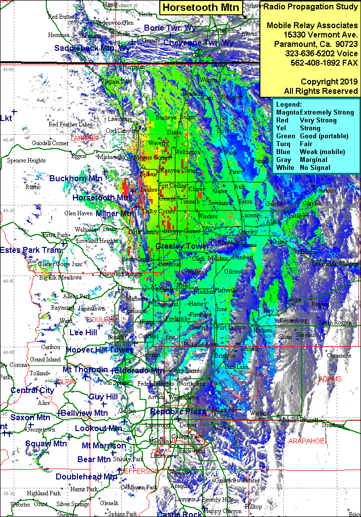 Horsetooth Mtn Coverage |
| Latitude: | 040 32 57.3N | 40.5492500 |
| Longitude: | 105 11 49.7W | -105.1971389 |
| Feet | Meters | |
| Ground Elevation: | 7,144.0 | 2,177.5 |
| HAAT: | 1,342.5 | 409.2 |
| City: | Ft Collins | |
| County: | Larimer | |
| State: | Colorado |
This is not an MRA Owned Site. For space rental contact the site owner.
Do you own or manage this site? Click Here
Would you like to add a site to the Google Earth Map?? Click Here
Site Coverage: Coverage of Ft. Collins, east to Cornish, south to Lafayette, north to the Wyoming state line