Hudson Tower
| Site Name: | Hudson Tower | 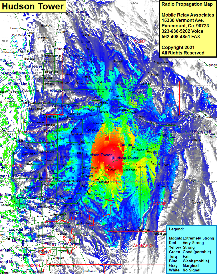 Hudson Tower Coverage |
| Latitude: | 040 07 18.1N | 40.1216944 |
| Longitude: | 104 36 17.5W | -104.6048611 |
| Feet | Meters | |
| Ground Elevation: | 4957.0 | 1510.9 |
| HAAT: | 196.3 | 59.8 |
| City: | Hudson | |
| County: | Weld | |
| State: | Colorado |
This is not an MRA Owned Site. For space rental contact the site owner.
Do you own or manage this site? Click Here
Would you like to add a site to the Google Earth Map?? Click Here
Site Coverage: Coverage of Hudson, Roy, Keenesburg, Tampa, Roggen, South Roggen, Griffin, Hoyt, Leader, Comanche, Prospect Valley, Sheehan, Tonville, Barr Lake, Hazeltine, Irondale, Montbello, Sable, Watkins, Manila, Bennett, Strasburg, Byers, Peiria, Aurura, Denver, Englewood, Littleton, Wolhurst, Sheridan, Grandview Estates, Beverly Hills, Northglenn, Eastlake, Broomfield, Superior, Lafayette, Hi-Land Acres, Powars, Fort Lupton, Vollmar, Ione, Maddux, Platteville, Houston, Gilcrest, Hambert, Dent, Bunyan, Wildcat, Mead, Kirkland, Morey, Hygiene, Dominion, Longmont, Jessum, Firestone, Frederick, Dacono, Saint Vrains, Ninemile Corner, Lafayette, Paragon Estates, Superior, Marshall, Magnolia, Boulder, Leyner, Niwot, Plumbs, Morey, Mead, HIghland Lake, Berthoud, Berts Corner, Campion, Kings Corner, Loveland, Harmony, Drakes, Omega, Timnath, Kluver, Giddings, Gates, Severance, Eaton, Ault, Pierce, Nunn, Dover, Purcell, Briggsdale, Fosston, Cornish, Matthews, Galeton, Lowe, Alden, Lucerne, Greeley, Garden City, Hambert, Evans, Kersey, Kuner, Hardin, Canton, Masters, Orchard, Goodrich, Weldona