Johnstown
| Site Name: | Johnstown | 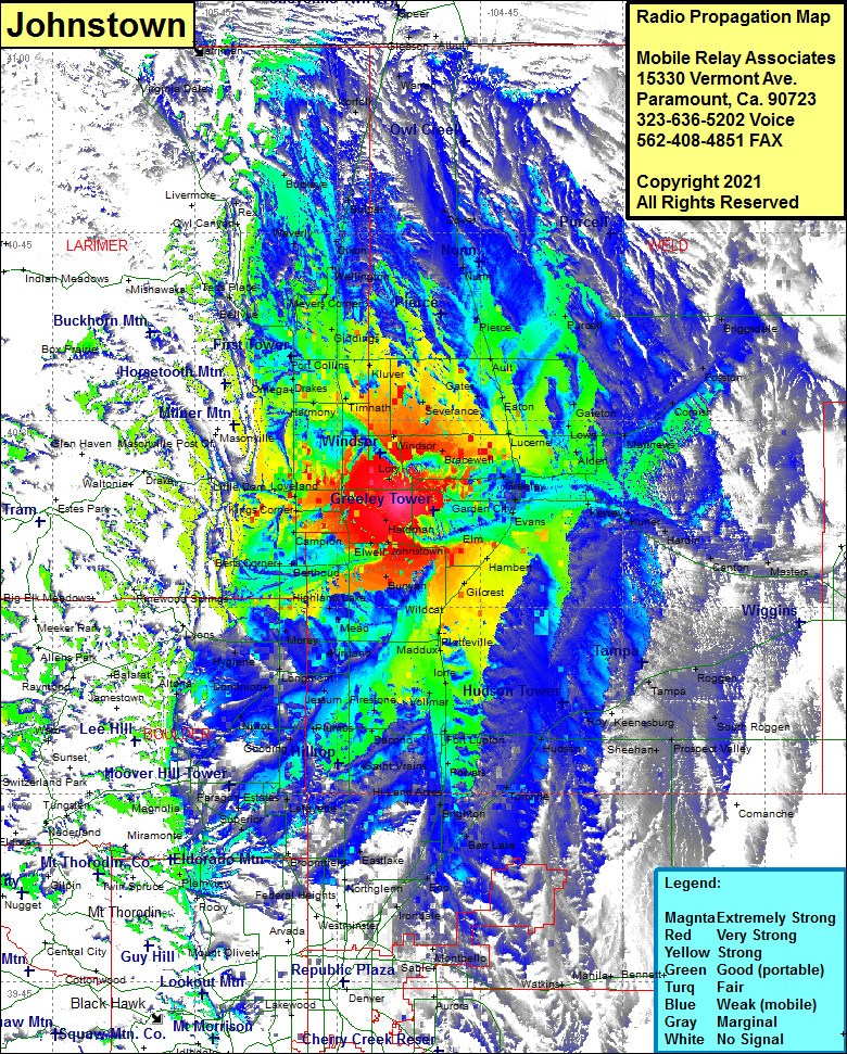 Johnstown Coverage |
| Latitude: | 040 23 30.5N | 40.3918056 |
| Longitude: | 104 53 24.0W | -104.8900000 |
| Feet | Meters | |
| Ground Elevation: | 5058.0 | 1541.7 |
| HAAT: | 372.5 | 113.5 |
| City: | Johnstown | |
| County: | Weld | |
| State: | Colorado |
This is not an MRA Owned Site. For space rental contact the site owner.
Do you own or manage this site? Click Here
Would you like to add a site to the Google Earth Map?? Click Here
Site Coverage: Coverage of Koenig, Hardman, Hillsboro, Johnstown, Milliken, Dent, Fort Saint Vrain, Bunyan, Pulliam, Elwell, Buda, Kahler, Welty, Campion, Kings Corner, Browns Corner, Loveland, Gove, Lory, Kems, Timnath, Harmony, Redmond, Trilby Corner, Bruce, Severance, Hurrich, Tuber, Gates, Corner, Bracewell, Farmers, Elm, Adna, Wildcat, Walker, Highland Lake, Houston, Gilcrest, Peckham, Hambert, Mead, Gowanda, Liberty, Morey, Hygiene, Lyons, Longmont, Dominion, Jessum, Harney, Firestone, Frederick, Dacono, Pleasant View Ridge, State Coal Mine Jct, Ninemile Corner, Hi-Land Acres, Lafayette, Louisville, Paraon Estates, Superior, Marshall, Eldorado Springs, Plainview, Broomfield, Eastlake, Northglenn, Rolla, Eno, Henderson, Brighton, Powars, Fort Lupton, Ione, Maddux, Platteville, Houston, Gilcrest, Hambert, La Salle, Evans, Auburn, Kersey, Kuner, Hardin, Canton, Dearfield, Masters, Greeley, Lowe, Galeton, Matthews, Cornish, Fosston, Briggsdale, Lcerne, Eaton, Ault, Purcell, Pierce, Nunn, Dover, Grover, Gleason, Warren, Norfolk, Bulger, Buckeye, Virginia Dale, Harriman, Rex, Own Canyon, Waverly, Dixon, Bulger, Wellington, Fort Colling, Buckingham, Kluver, Drakes, Omega