Keota Tower
| Site Name: | Keota Tower | 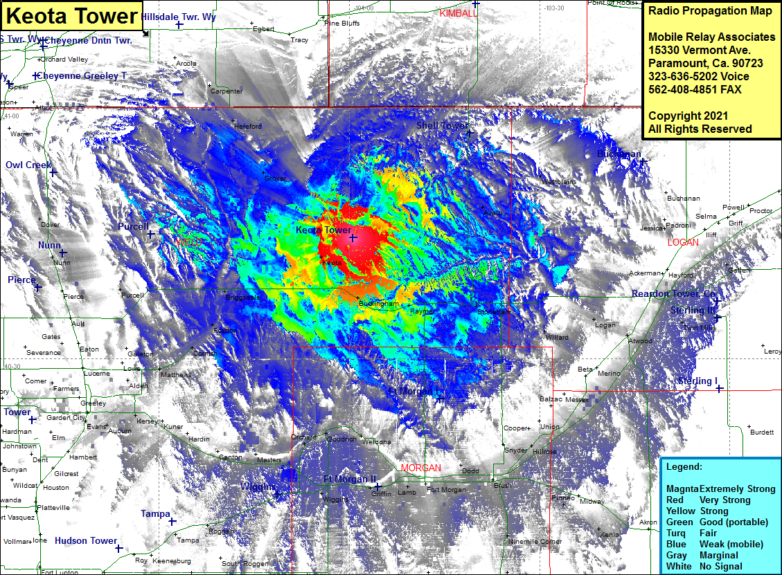 Keota Tower Coverage |
| Latitude: | 040 44 29.4N | 40.7415000 |
| Longitude: | 103 59 25.0W | -103.9902778 |
| Feet | Meters | |
| Ground Elevation: | 5041.0 | 1536.5 |
| HAAT: | 246.5 | 75.1 |
| City: | Keota | |
| County: | Weld | |
| State: | Colorado |
This is not an MRA Owned Site. For space rental contact the site owner.
Do you own or manage this site? Click Here
Would you like to add a site to the Google Earth Map?? Click Here
Site Coverage: Coverage of Avalo, Westplains, Keota, Buckingham, Raymer, Stoneham, Willard, Logan, Atwood, Mering, Messex, Balzac, Union , Cooper, Snyder, Hillrose, Camden, Dodd, Brush, Pinneo, Nelson, Fort Morgan, Lamb, Hurley, Bijou, Griffin, Weldona, Goodrich, Orchard, Sublette, Masters, Dearfield, Alden, Matthews, Cornish, Fosston, Briggsdale, Purcell, Keota, Grover, Hereford, Carpenter