La Junta
| Site Name: | La Junta | 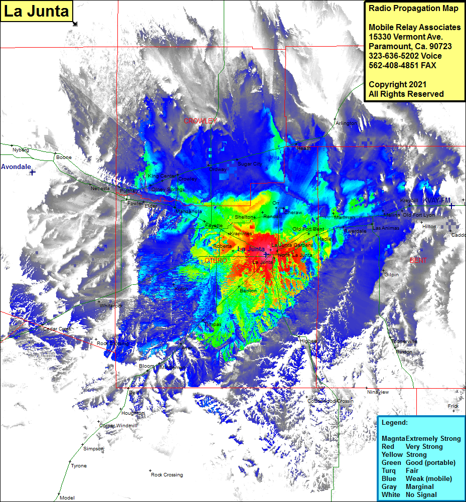 La Junta Coverage |
| Latitude: | 037 59 13.9N | 37.9871944 |
| Longitude: | 103 34 03.2W | -103.5675556 |
| Feet | Meters | |
| Ground Elevation: | 4111.0 | 1253.0 |
| HAAT: | 64.6 | 19.7 |
| City: | La Junta | |
| County: | Otero | |
| State: | Colorado |
This is not an MRA Owned Site. For space rental contact the site owner.
Do you own or manage this site? Click Here
Would you like to add a site to the Google Earth Map?? Click Here
Site Coverage: Coverage of La Junta, La Junta Village, La Junta Gardens, North La Junta, Old Fort Bent, Riverdale, Marlman, Las Animas, Melina, Old Fort Lyon, Kreybill, Hilton, Caddoa, Lubers, Gilpin, Toonerville, Ruxton, Benton, Timpas, Ayer, Minderman, Bloom, Kutch, Whitrock, Swink, Krammes, Fayette, Manzanola, Elder, Fowler, Pultney, Hamlet, Nepesta, Olney Springs, Kings Corner, Olney Springs, King Center, Crowley, Ordway, Sugar City, Heath, Haswell