Lamar
| Site Name: | Lamar | 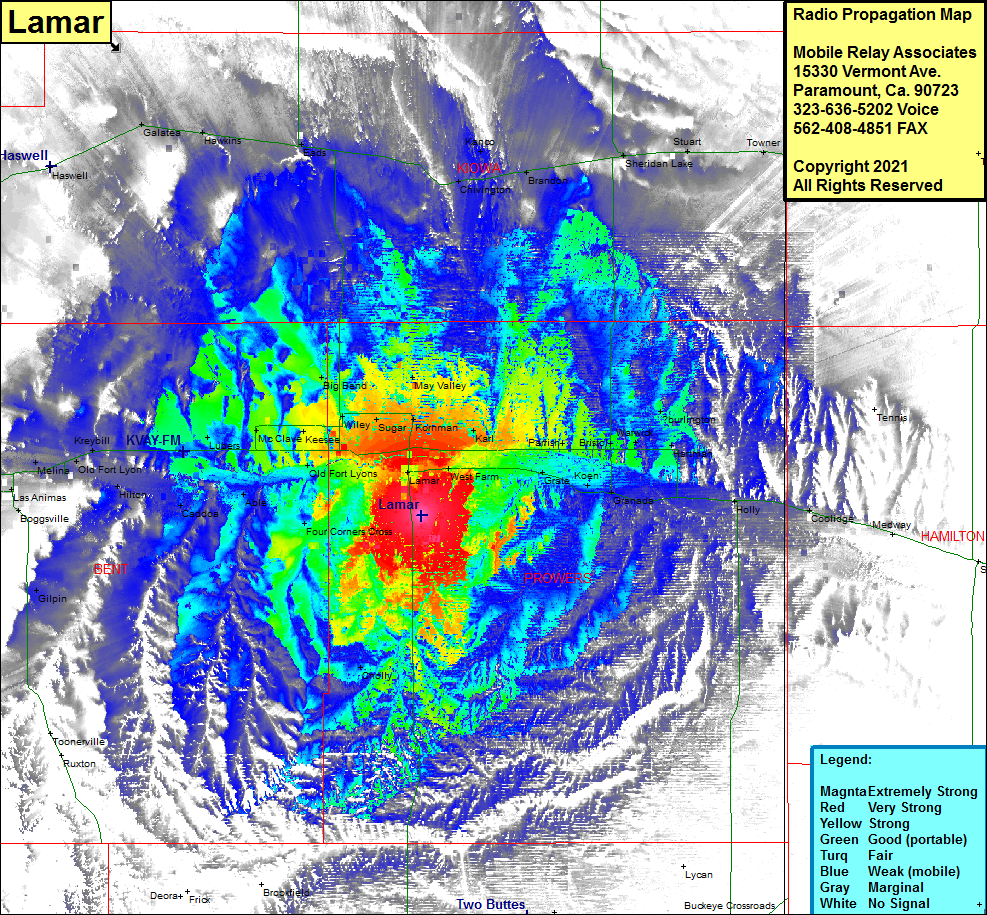 Lamar Coverage |
| Latitude: | 038 02 10.3N | 38.0361944 |
| Longitude: | 102 35 58.6W | -102.5996111 |
| Feet | Meters | |
| Ground Elevation: | 3793.0 | 1156.1 |
| HAAT: | 198.7 | 60.5 |
| City: | Lamar | |
| County: | Prowers | |
| State: | Colorado |
This is not an MRA Owned Site. For space rental contact the site owner.
Do you own or manage this site? Click Here
Would you like to add a site to the Google Earth Map?? Click Here
Site Coverage: Coverage of Lamar, West Farm, Grate, Koen, Granada, Holly, Coolidge, Two Buttes, Cholly, Four Corners Crossing, Old Fort Lyons, McClave, Keesee, Wiley, Sugar, Kornman, Karl, Parrish, Bristol, Warwick, Hartman, Able, Lubers, Caddoa, Hilton, Old Fort Lyon, Melina, Kreybill, Las Animas, Boggsville, Riverdale, Cornelia, Big Benk, May Valley, Eads, Hawkins, Galatea, Haswell, Chivington, Kanco, Brandon, Sheridan Lake, Stuart, Tower, Walkinghood