Lee Hill
| Site Name: | Lee Hill | 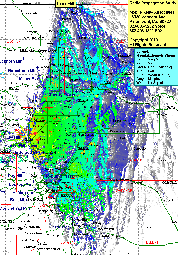 Lee Hill Coverage |
| Latitude: | 040 04 20.0N | 40.0722222 |
| Longitude: | 105 21 15.5W | -105.3543056 |
| Feet | Meters | |
| Ground Elevation: | 7,897.0 | 2,407.0 |
| HAAT: | 996.5 | 303.7 |
| City: | Boulder | |
| County: | Boulder | |
| State: | Colorado |
This is not an MRA Owned Site. For space rental contact the site owner.
Do you own or manage this site? Click Here
Would you like to add a site to the Google Earth Map?? Click Here
Site Coverage: Coverage of Boulder, Denver, Lee Hill, Orodell, Magnolia, south to Littleton, north to Dixon, east to Augurn & Toneville