Limon II
| Site Name: | Limon II | 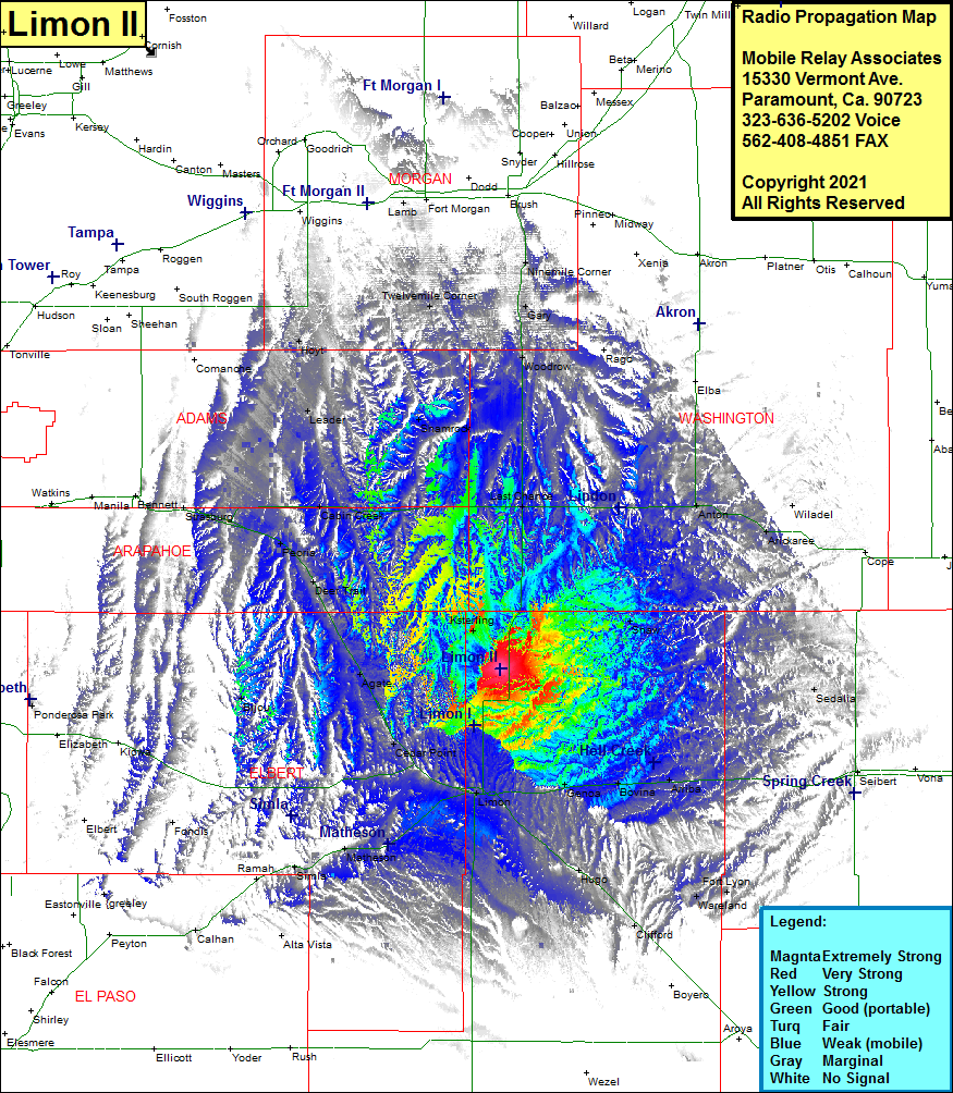 Limon II Coverage |
| Latitude: | 039 28 11.7N | 39.4699167 |
| Longitude: | 103 38 16.0W | -103.6377778 |
| Feet | Meters | |
| Ground Elevation: | 5597.0 | 1706.0 |
| HAAT: | 324.2 | 98.8 |
| City: | Limon | |
| County: | Lincoln | |
| State: | Colorado |
This is not an MRA Owned Site. For space rental contact the site owner.
Do you own or manage this site? Click Here
Would you like to add a site to the Google Earth Map?? Click Here
Site Coverage: Coverage of Limon, Genoa, Bovina, Arriba, Flagler, Seibert, Hugo, Wareland, Fort Lyon, Clifford, Matheson, Simla, Calhan, Cedar Point, Agate, Deer Trail, Peoria, Byers, Cabin Creek, Leader, Shamrock, Hoyt, Twelvemile Corner, Last Chance, Anton, Arickaree, Shaw, Sedalia