Manitou Springs
| Site Name: | Manitou Springs | 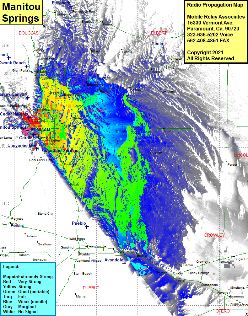 Manitou Springs Coverage |
| Latitude: | 038 49 46.4N | 38.8295556 |
| Longitude: | 104 55 22.4W | -104.9228889 |
| Feet | Meters | |
| Ground Elevation: | 8508.0 | 2593.2 |
| HAAT: | 156.7 | 47.8 |
| City: | Manitou Springs | |
| County: | El Paso | |
| State: | Colorado |
This is not an MRA Owned Site. For space rental contact the site owner.
Do you own or manage this site? Click Here
Would you like to add a site to the Google Earth Map?? Click Here
Site Coverage: Coverage of Colorado Springs, Roswell, Pikeview, Elesmere, Shirley, Falcon, Black Forest, La Foret, Monument, Eastonville, Greenland, Peyton, Falcon, Calhan, Ramah, Simla, Alta Vista, Rush, Yoder, Ellicott, Truckton, Fountain, Buttes, Wigwam, Boone, Nepesta, Fowler, Manzanola, Fayette