Menefee Mtn
| Site Name: | Menefee Mtn | 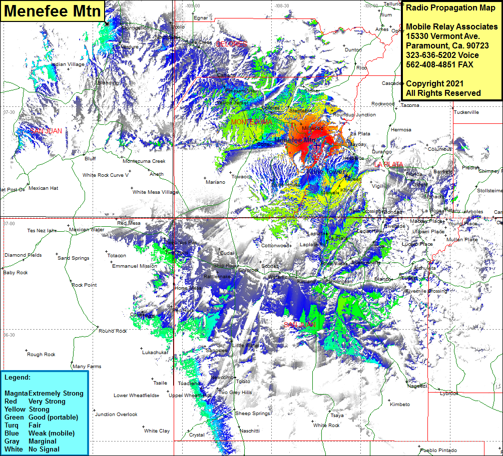 Menefee Mtn Coverage |
| Latitude: | 037 19 32.1N | 37.3255833 |
| Longitude: | 108 14 56.1W | -108.2489167 |
| Feet | Meters | |
| Ground Elevation: | 8837.0 | 2693.5 |
| HAAT: | 1329.6 | 405.3 |
| City: | Mancos | |
| County: | Montezuma | |
| State: | Colorado |
This is not an MRA Owned Site. For space rental contact the site owner.
Do you own or manage this site? Click Here
Would you like to add a site to the Google Earth Map?? Click Here
Site Coverage: Coverage of Mancos, Millwood, Dolores, Lebanon, Arriola, Lewis, Yellow Jacket, Roundup Junction, Breen, Kline, Marvel, Redmesa, US Highway 160 from southwest of Cortez to 12 miles east of Mancos