Mt Calahan
| Site Name: | Mt Calahan | 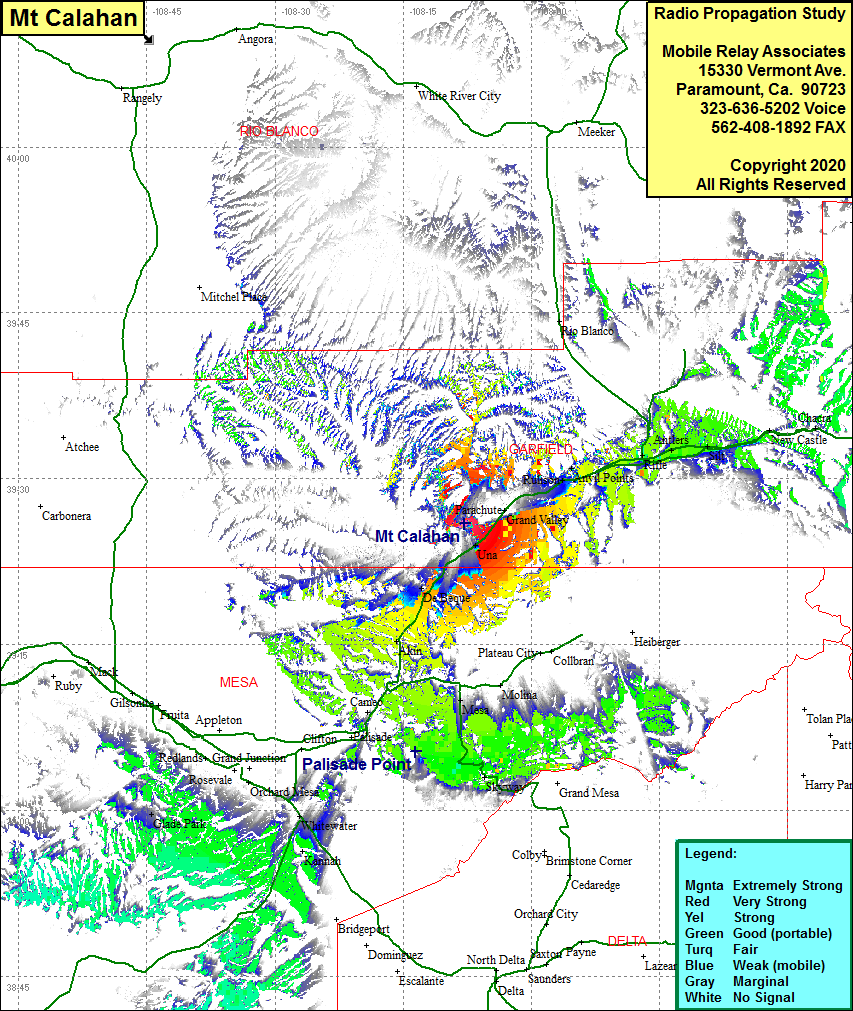 Mt Calahan Coverage |
| Latitude: | 039 25 59.2N | 39.4331111 |
| Longitude: | 108 07 49.6W | -108.1304444 |
| Feet | Meters | |
| Ground Elevation: | 8677.8 | 2645.0 |
| HAAT: | 2346.2 | 715.1 |
| City: | Parachutte | |
| County: | Garfield | |
| State: | Colorado |
This is not an MRA Owned Site. For space rental contact the site owner.
Do you own or manage this site? Click Here
Would you like to add a site to the Google Earth Map?? Click Here
Site Coverage: Coverage of Grand Valley, Una, De Beque, Akin, John Held Corner, Glade Park, Rifle, Antlers, Lacy, Anvil Points, Rulison