Nunn
| Site Name: | Nunn | 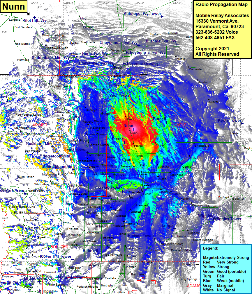 Nunn Coverage |
| Latitude: | 040 42 41.3N | 40.7114722 |
| Longitude: | 104 45 07.3W | -104.7520278 |
| Feet | Meters | |
| Ground Elevation: | 5200.0 | 1585.0 |
| HAAT: | 71.7 | 21.9 |
| City: | Nunn | |
| County: | Weld | |
| State: | Colorado |
This is not an MRA Owned Site. For space rental contact the site owner.
Do you own or manage this site? Click Here
Would you like to add a site to the Google Earth Map?? Click Here
Site Coverage: Coverage of Nunn, Pierce, Purcell, Eaton, Galeton, Cornish, Fosston, Briggsdale, Buckingham, Keota, Grover, Hereford, Carpenter, Arcola, Archer, Cheyenne, Otto, Herriman, Virginia Dale, Buckeye, Rex, Wellington, Kluver, Ault, Severance, Windsor, Lucerne, Drakes, Mishawaka, Campion, Elm, Berthbud, Bunyan, Johnstown, Gilcrest, Evans, Greeley, Alden, Galeton, Hardin, Masters, Orchard, Roggen, Tampa, Platteville, Gilcrest, Roy, Fort Lupton, Brighton, Tonville, Sheehan, Keenesburg, South Roggen