Palisade Point
| Site Name: | Palisade Point | 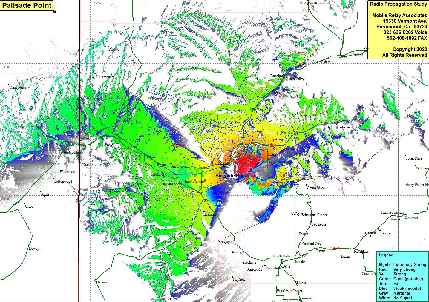 Palisade Point Coverage |
| Latitude: | 039 05 21.9N | 39.0894167 |
| Longitude: | 108 13 35.3W | -108.2264722 |
| Feet | Meters | |
| Ground Elevation: | 9940.9 | 3030.0 |
| HAAT: | 68.9 | 21.0 |
| City: | Palisade | |
| County: | Mesa | |
| State: | Colorado |
This is not an MRA Owned Site. For space rental contact the site owner.
Do you own or manage this site? Click Here
Would you like to add a site to the Google Earth Map?? Click Here
Site Coverage: Coverage of mesa, John Held Corner, Skyway, Molina, Plateau City, Collbran, Akin, De Beque, Cameo, Palisade, Mt Lincoln, Clifton, Fruitvale, Johnsons Corner, Orchard Mesa, Whitewaater, Rosevale, Redlands, Durham, Appleton, Rhone, Fruita, Gilsonite, Loma, Mack, Harley Dome, Utaline