Pueblo
| Site Name: | Pueblo | 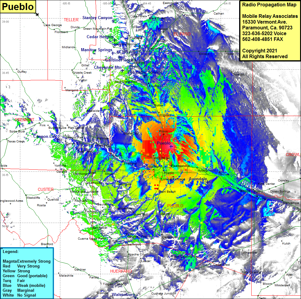 Pueblo Coverage |
| Latitude: | 038 22 24.1N | 38.3733611 |
| Longitude: | 104 33 30.5W | -104.5584722 |
| Feet | Meters | |
| Ground Elevation: | 5350.0 | 1630.7 |
| HAAT: | 539.3 | 164.4 |
| City: | Pueblo | |
| County: | Pueblo | |
| State: | Colorado |
This is not an MRA Owned Site. For space rental contact the site owner.
Do you own or manage this site? Click Here
Would you like to add a site to the Google Earth Map?? Click Here
Site Coverage: Coverage of Bragdon, Pinon, Wild Horse, Fearnowville, Pueblo, Vineland, Lombard Village, Goodnight, Devine, Nyberg, Boone, Nepesta, Pulney, Fowler, Elder, Olney Springs, Crowley, Stem Beach, Marnel, Burnt Mill, Cedarwood, Colorado City, Greenwood, Apache City, Lascar, Rock Crossing, Rye, Cuerna Verde Park, San Isabel, Beulah, Goodpasture, Fairview, Bronquist, Siloam, Sikea, Wetmore, Swallows, Hobson, Portland, Florence, Coal Creek, Canon City, Lincoln Park, Park Center, Stone City, Rock Creek Park, Fountain, Buttes, Wigwam, Elesmere, Shirley, Falcon