Purcell Tower
| Site Name: | Purcell Tower | 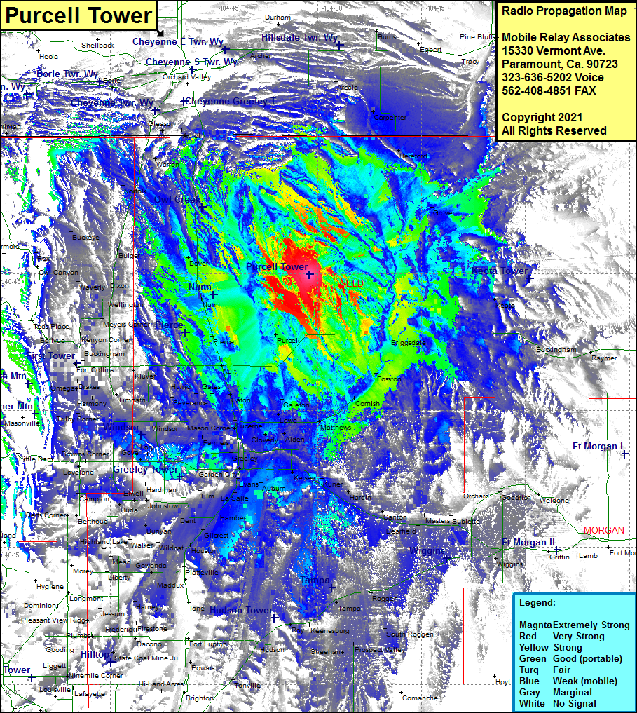 Purcell Tower Coverage |
| Latitude: | 040 44 54.4N | 40.7484444 |
| Longitude: | 104 31 13.5W | -104.5204167 |
| Feet | Meters | |
| Ground Elevation: | 5262.0 | 1603.9 |
| HAAT: | 270.0 | 82.3 |
| City: | Purcell | |
| County: | Weld | |
| State: | Colorado |
This is not an MRA Owned Site. For space rental contact the site owner.
Do you own or manage this site? Click Here
Would you like to add a site to the Google Earth Map?? Click Here
Site Coverage: Coverage of Purcell, Briggsdale, Buckingham, Raymer, Fosston, Cornish, Matthews, Kersey, Kuner, Hardin, Canton, Dearfield, Roggen, Tampa, Roy, Hudson, Tonville, Powars, Houston, Gilcrest, Hambert, LaSalle, Evans, Auburn, Garden City, Greeley, Elm, Dent, Wildcat, Bunyan, Walker, Gowanda, Harney, Jessum, Gooding, Mead, Johnstown, Buda, Campion, Berts Corner, Gove, Lory, WIndsor, Mason Corner, Farmers, Cloverly, Alden, Lowe, Galeton, Eaton, Lucerne, Serverance, Hurrich, Gates, Timnath, Kluver, Drakes, Omega, Fort Collins, Buckingham, Meyers Corner, Waverly, Dixon, Bulger, Buckeye, Walker, Athol, Gleason, Arcola, Carpenter, Hereford, Grover, Keota