San Luis
| Site Name: | San Luis | 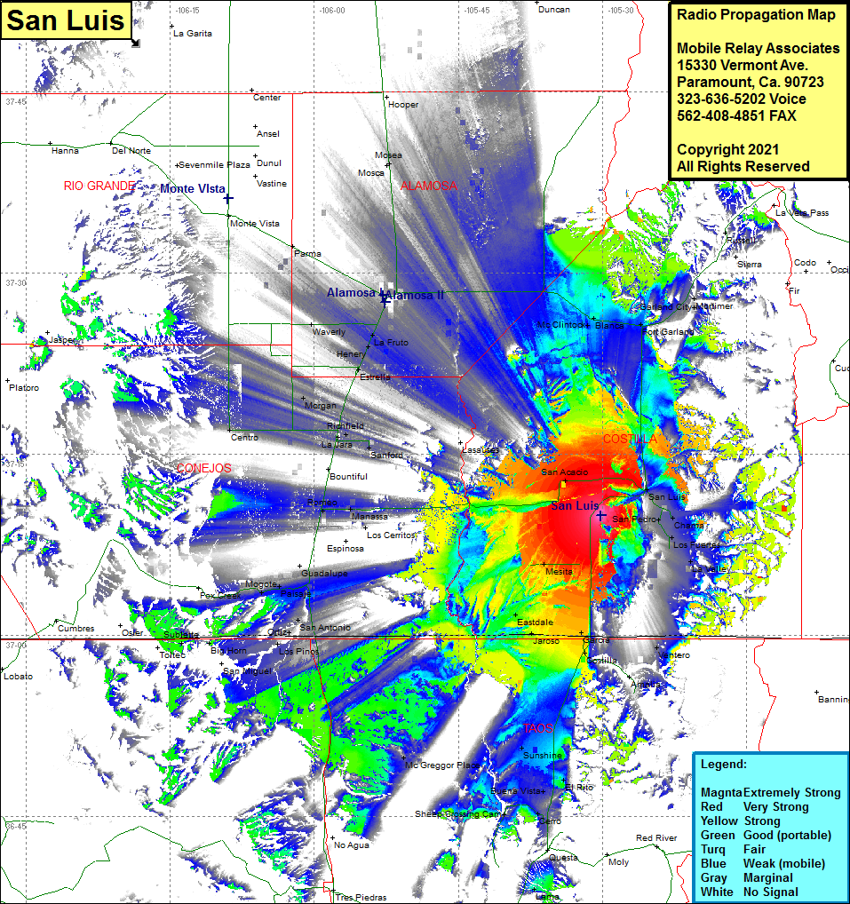 San Luis Coverage |
| Latitude: | 037 09 55.0N | 37.1652778 |
| Longitude: | 105 30 11.8W | -105.5032778 |
| Feet | Meters | |
| Ground Elevation: | 8019.0 | 2444.2 |
| HAAT: | 105.1 | 32.0 |
| City: | San Luis | |
| County: | Costilla | |
| State: | Colorado |
This is not an MRA Owned Site. For space rental contact the site owner.
Do you own or manage this site? Click Here
Would you like to add a site to the Google Earth Map?? Click Here
Site Coverage: Coverage of San Acacio, San Luis, San Pedro, Chama, Los Fuertes, LaValley, Mesita, Eastdale, Garcia, Costilla, Ventero, Amalia, Sunshine, Buena Vista, El Rito, Cerro, McGreggor Place, Sheep Crossing Cam, Los Pinos, Big Horn, Subletta, San Miguel, San Antonio, Manassa, Romeo, Bountiful, Sanford, Richfield, Sanford, Morgan, Estrella, Henery, La Fruto, Waverly, Parma, McClintock, Blanca, Fort Garland, Garland City, Mortimer