Smelter Mtn
| Site Name: | Smelter Mtn | 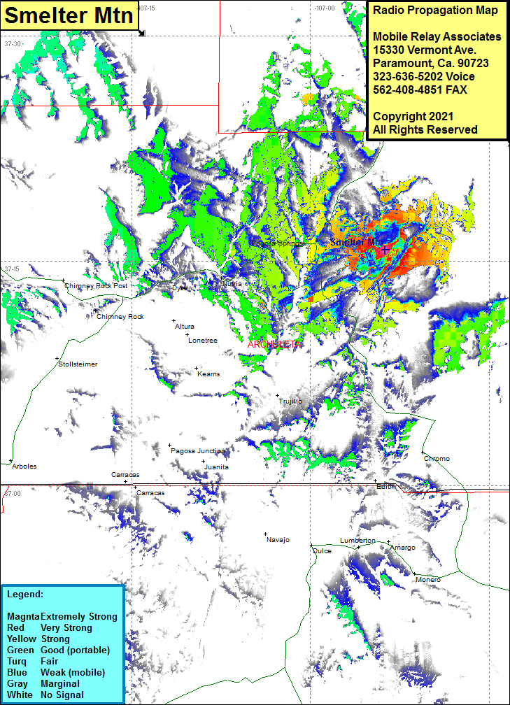 Smelter Mtn Coverage |
| Latitude: | 037 15 45.0N | 37.2625000 |
| Longitude: | 106 53 44.0W | -106.8955556 |
| Feet | Meters | |
| Ground Elevation: | 8428.0 | 2568.9 |
| HAAT: | 171.9 | 52.4 |
| City: | Pagosa Springs | |
| County: | Archuleta | |
| State: | Colorado |
This is not an MRA Owned Site. For space rental contact the site owner.
Do you own or manage this site? Click Here
Would you like to add a site to the Google Earth Map?? Click Here
Site Coverage: Coverage of Pagosa Springs, Nutria, Dyke, portions of US Highway 80 through Pagosa Springs area and US Highway 84 heading south from Pagosa Springs