Spring Creek
| Site Name: | Spring Creek | 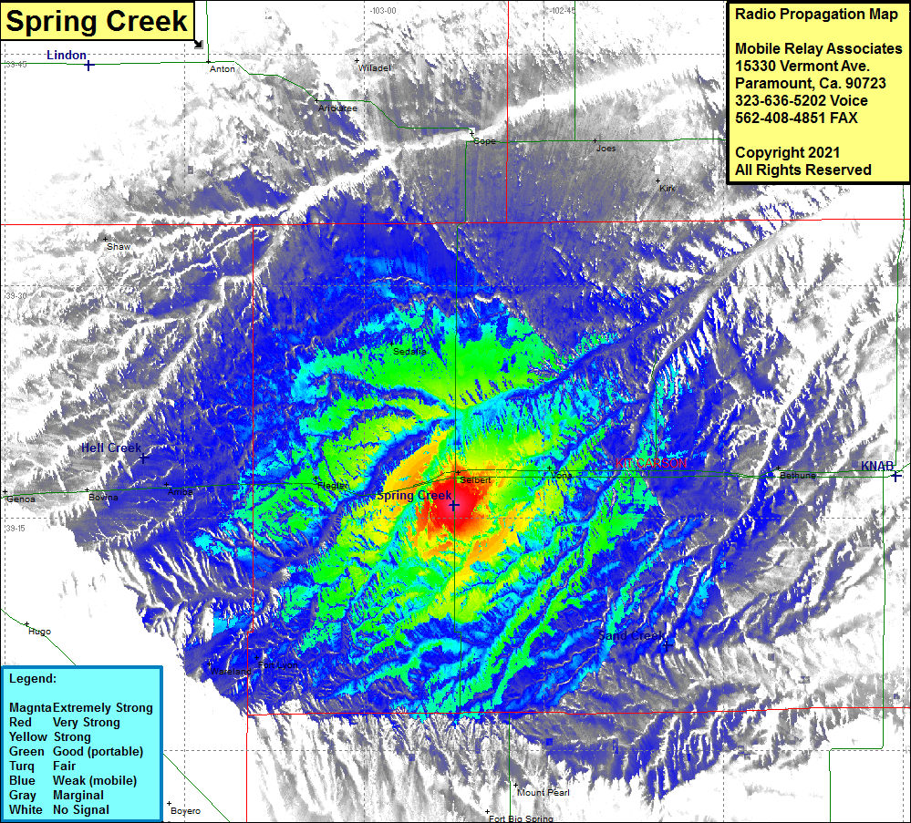 Spring Creek Coverage |
| Latitude: | 039 15 48.8N | 39.2635556 |
| Longitude: | 102 52 29.7W | -102.8749167 |
| Feet | Meters | |
| Ground Elevation: | 4766.0 | 1452.7 |
| HAAT: | 221.1 | 67.4 |
| City: | Seibert | |
| County: | Kit Carson | |
| State: | Colorado |
This is not an MRA Owned Site. For space rental contact the site owner.
Do you own or manage this site? Click Here
Would you like to add a site to the Google Earth Map?? Click Here
Site Coverage: Coveage of Seibert, Vona, Berthune, Mount Pearl, Fort Lyon, Wareland, Arriba, Flager, Sedalia, Shaw, Arickaree, Wiladel, Copa, Joes, Kirk