Springfield I
| Site Name: | Springfield I | 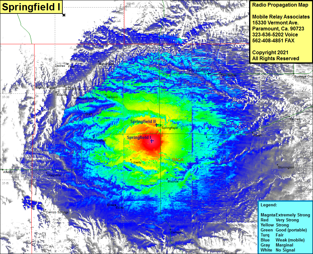 Springfield I Coverage |
| Latitude: | 037 21 44.2N | 37.3622778 |
| Longitude: | 102 38 46.3W | -102.6461944 |
| Feet | Meters | |
| Ground Elevation: | 4533.0 | 1381.7 |
| HAAT: | 263.0 | 80.2 |
| City: | Springfield | |
| County: | Baca | |
| State: | Colorado |
This is not an MRA Owned Site. For space rental contact the site owner.
Do you own or manage this site? Click Here
Would you like to add a site to the Google Earth Map?? Click Here
Site Coverage: Coverage of Springfield, Vilas, Walsh, Bartlett, Saunders, Bisonte, Stonington, Midway, Campo, Elden, Elder, Pritchett, Graft, Harboro, Antelope Springs, S Crossing, Atlanta, Murray Place, Frick, Brookfield, Two Buttes, Lycan, Buckeye Crossroads, Andrix, Utleyville