Sterling II
| Site Name: | Sterling II | 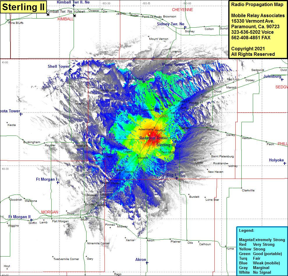 Sterling II Coverage |
| Latitude: | 040 37 43.6N | 40.6287778 |
| Longitude: | 103 09 59.5W | -103.1665278 |
| Feet | Meters | |
| Ground Elevation: | 4006.0 | 1221.0 |
| HAAT: | 69.1 | 21.1 |
| City: | Sterling | |
| County: | Logan | |
| State: | Colorado |
This is not an MRA Owned Site. For space rental contact the site owner.
Do you own or manage this site? Click Here
Would you like to add a site to the Google Earth Map?? Click Here
Site Coverage: Coverage of Galien, Fleming, Dailey, Haxtun, Saint Petersburg, Leroy, Rockland, New Haven, Clarkville, Lone Star, Burdett, Schramm, Yuma, Calhoun, Otis, Platner, Akron, Xenia, Midway, Pinneo, Camden, Hillrose, Snyder, Cooper, Balzac, Messex, Beta, Merino, Atwood, Logan, Willard, Ackerman, Hayford, Iliff, Selma, Proctor, Tobin, Crook, Marcott, Padroni, Jessica, Buchanan