Storm Peak
| Site Name: | Storm Peak | 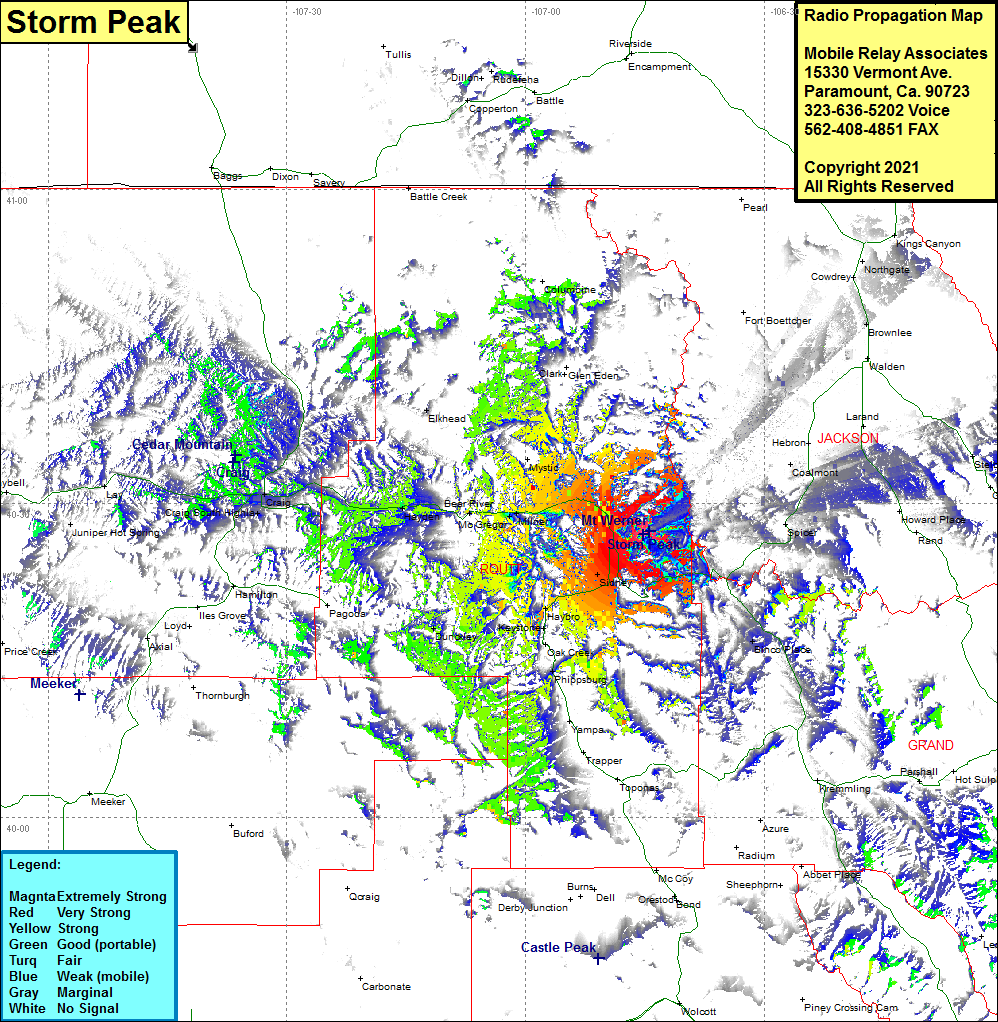 Storm Peak Coverage |
| Latitude: | 040 27 04.8N | 40.4513333 |
| Longitude: | 106 45 06.1W | -106.7516944 |
| Feet | Meters | |
| Ground Elevation: | 10299.0 | 3139.1 |
| HAAT: | 1790.8 | 545.8 |
| City: | Steamboat Springs | |
| County: | Routt | |
| State: | Colorado |
This is not an MRA Owned Site. For space rental contact the site owner.
Do you own or manage this site? Click Here
Would you like to add a site to the Google Earth Map?? Click Here
Site Coverage: Coverage of Sidney, Steamboat Springs, Milner, Bear River, Hayden, Craig, Craig South Highlands, Elkhead