Trinidad
| Site Name: | Trinidad | 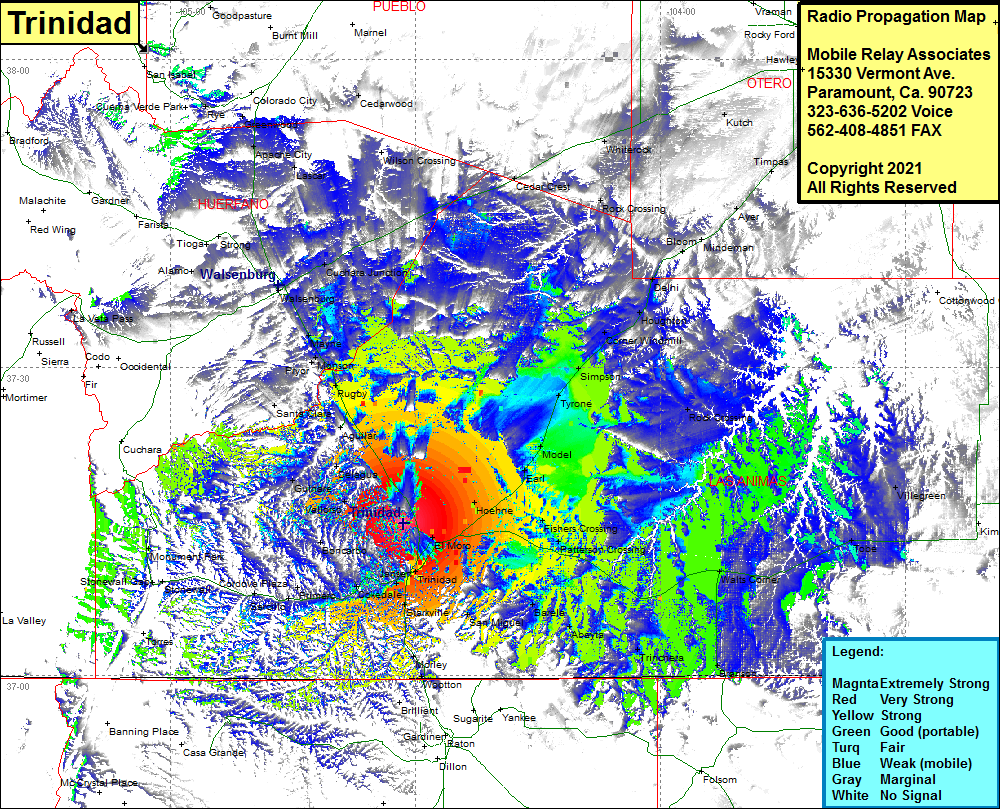 Trinidad Coverage |
| Latitude: | 037 14 51.5N | 37.2476389 |
| Longitude: | 104 31 32.1W | -104.5255833 |
| Feet | Meters | |
| Ground Elevation: | 7215.0 | 2199.1 |
| HAAT: | 932.4 | 284.2 |
| City: | Trinidad | |
| County: | Las Animas | |
| State: | Colorado |
This is not an MRA Owned Site. For space rental contact the site owner.
Do you own or manage this site? Click Here
Would you like to add a site to the Google Earth Map?? Click Here
Site Coverage: Coverage of Ludlow, Aguilar, Lynn, Rugby, Monson, Mayne, Pryor, Rouse, Santa Clara, Walsenburg, Cuchara Junction, Lascar, Apache City, Greenwood, Cedarwood, Cedar Crest, Whiterock, Rock Crossing, Kutch, Timpas, Ayer, Minderman, Bloom, Delhi, Houghton, Corner Windmill, Simpson, Tyrone, Model, Earl, Hoehne, Fishers Crossing, Patterson Crossing, Watts Corner, Tobe, Lone Oak, Branson, Trinchera, Abeyta, Barela, San Miguel, Starkville, Trinidad, El Moro, Jansen, Cokedale, Boncarbo, Primero, Monument Park, Reilly Canyon, Vallarso, Gulnare, Delagua