Vail I
| Site Name: | Vail I | 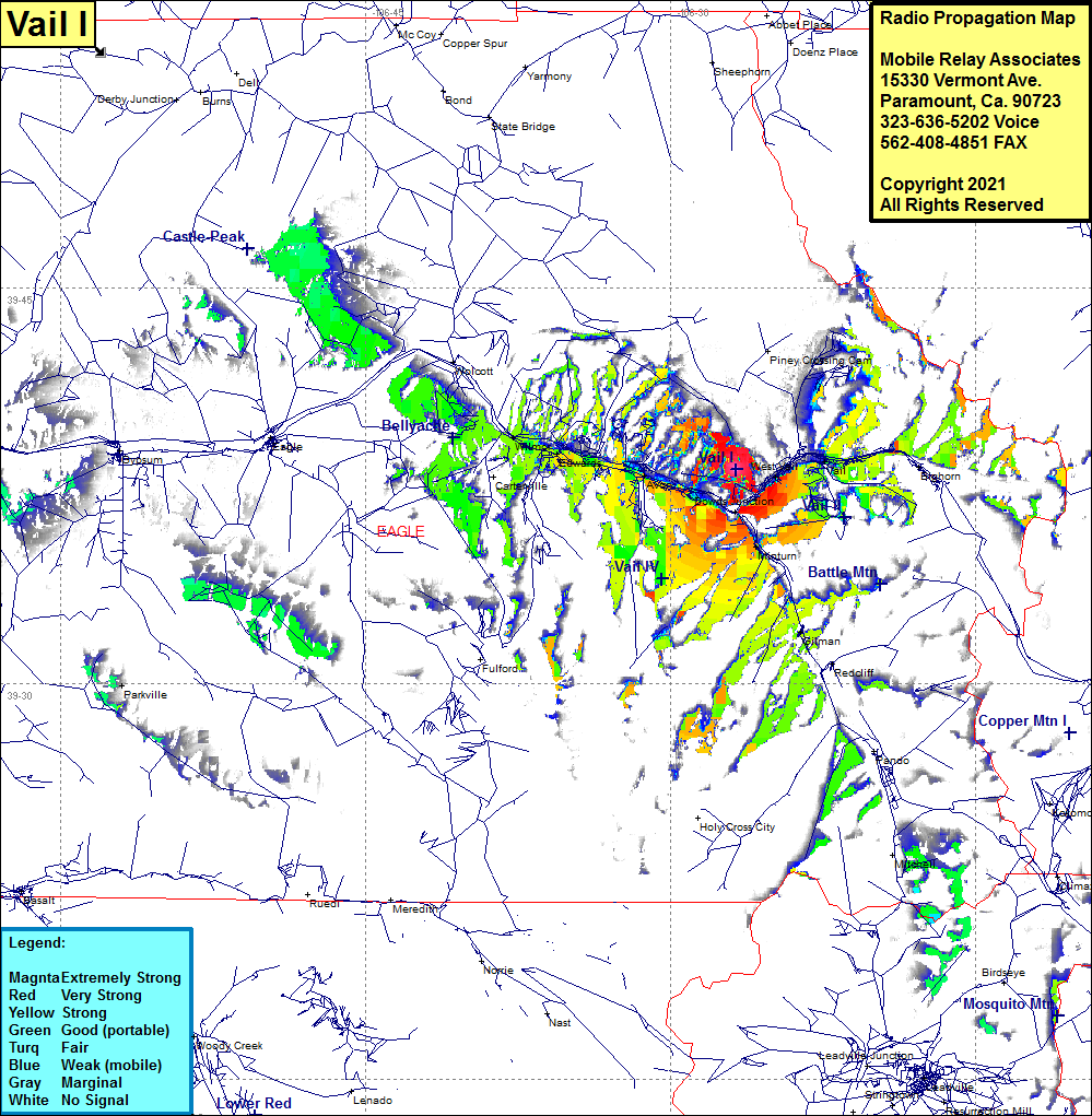 Vail I Coverage |
| Latitude: | 039 38 05.3N | 39.6348056 |
| Longitude: | 106 26 49.2W | -106.4470000 |
| Feet | Meters | |
| Ground Elevation: | 9693.0 | 2954.4 |
| HAAT: | 202.3 | 61.7 |
| City: | Vail | |
| County: | Eagle | |
| State: | Colorado |
This is not an MRA Owned Site. For space rental contact the site owner.
Do you own or manage this site? Click Here
Would you like to add a site to the Google Earth Map?? Click Here
Site Coverage: Coverage of Vail, Avon, Wilmor, Gilman, Interstate 70 from Vail to Wolcott