W Mountain
| Site Name: | W Mountain | 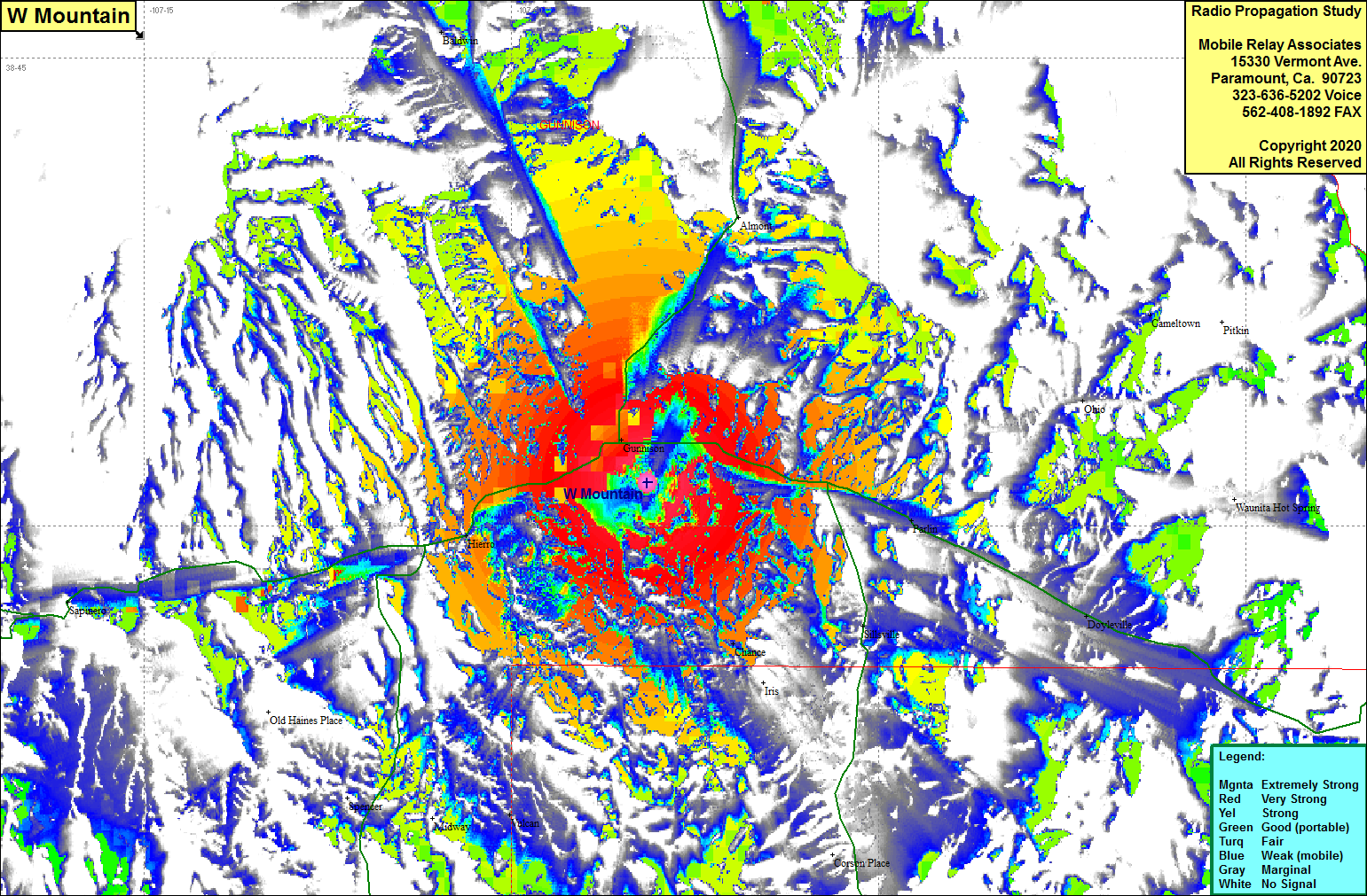 W Mountain Coverage |
| Latitude: | 038 31 24.0N | 38.5233333 |
| Longitude: | 106 54 27.2W | -106.9075556 |
| Feet | Meters | |
| Ground Elevation: | 8605.6 | 2623.0 |
| HAAT: | 350.0 | 106.7 |
| City: | Gunnison | |
| County: | Gunnison | |
| State: | Colorado |
This is not an MRA Owned Site. For space rental contact the site owner.
Do you own or manage this site? Click Here
Would you like to add a site to the Google Earth Map?? Click Here
Site Coverage: Coverage of Gunnison, Parlin, Chance, Vulcan, Hierro, Doyleville, Ohio, Cameltown, Highway 135 from Gunnison going north to Almont, Highway 50 east from Gunnison past Doyleville, west past Hierro to Sapinero