Walsenburg
| Site Name: | Walsenburg | 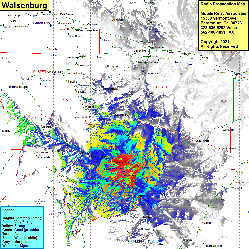 Walsenburg Coverage |
| Latitude: | 037 37 58.1N | 37.6328056 |
| Longitude: | 104 46 51.0W | -104.7808333 |
| Feet | Meters | |
| Ground Elevation: | 6428.0 | 1959.3 |
| HAAT: | 159.9 | 48.7 |
| City: | Walsenburg | |
| County: | Huerfano | |
| State: | Colorado |
This is not an MRA Owned Site. For space rental contact the site owner.
Do you own or manage this site? Click Here
Would you like to add a site to the Google Earth Map?? Click Here
Site Coverage: Coverage of Walsenburg, Cuchara Junction, Cedar Crest, Mayne, Monson, Pryor, Rouse, Rugby, Lynn, Auilar, Ludlow, Valorso, Santa Clara, La Veta, Cuchara, Occidental, Alamo, Gordon, Strong, Tioga, Badito, Farista, Gardner, Malachite, Apache City, Lascar, Greenwood, Colorado City, Rye, Marnel, Burnt Mill, Cedarwood, Stem Beach, Simpson, Tyrone, Hoehne