Wiggins
| Site Name: | Wiggins | 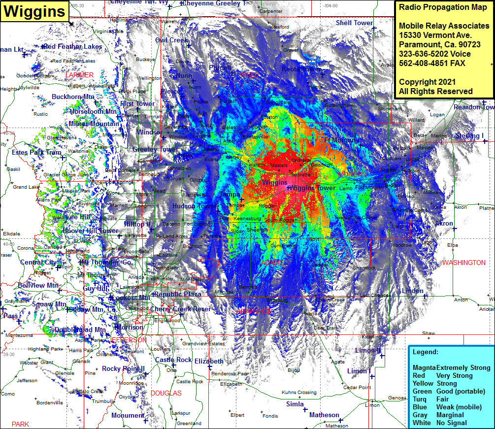 Wiggins Coverage |
| Latitude: | 040 13 46.1N | 40.2294722 |
| Longitude: | 104 11 21.0W | -104.1891667 |
| Feet | Meters | |
| Ground Elevation: | 4757.0 | 1449.9 |
| HAAT: | 334.7 | 102.0 |
| City: | Wiggins | |
| County: | Weld | |
| State: | Colorado |
This is not an MRA Owned Site. For space rental contact the site owner.
Do you own or manage this site? Click Here
Would you like to add a site to the Google Earth Map?? Click Here
Site Coverage: Coverage of Orchard, Goodrich, Keota, Buckingham, Grover, Avalo, Westplains, Stoneham, Willard, Beta, Atwood, Merino, Beta, Balzac, Messex, Union, Cooper, Snyder, Hillrose, Brush, Pinneo, Midway, Xenia, Ninemile Corner, Gary, Twelvemile Corner, Woodrow, Rago, Gary, Shamrock, Leader, Last Chance, Cabin Creek, Strasburg, Bennett, Manila, Watkins, Aurora, Montbello, Irondale, Eno, Barr Lake, Brighton, Tonville, Hudson, Roy, Prospect Valley, Roggen, Tampa, Brighton, Powars, Fort Lupton, Ione, Maddux, Platteville, Wildcat, Gilcrest, Hambert, LaSalle, Evans, Rosedale, Greeley, Adna, Johnstonw, Buda, Berthud, Welty, Kings Corner, Berts Corner, Berthud, Highland Lake, Mead, Kirkland, Morey, Marnett, Timnath, Omega, Sinnard, Arrowhead, Gates, Severance, Eaton, Lucerne, Lowe, Galeton, Purcell, Pierce, Nunn, Dover, Sinnard, Arrowhead, Giddings, Alden, Matthews, Cornish, Fosston, Briggsdale, Grover