Wild Horse II
| Site Name: | Wild Horse II | 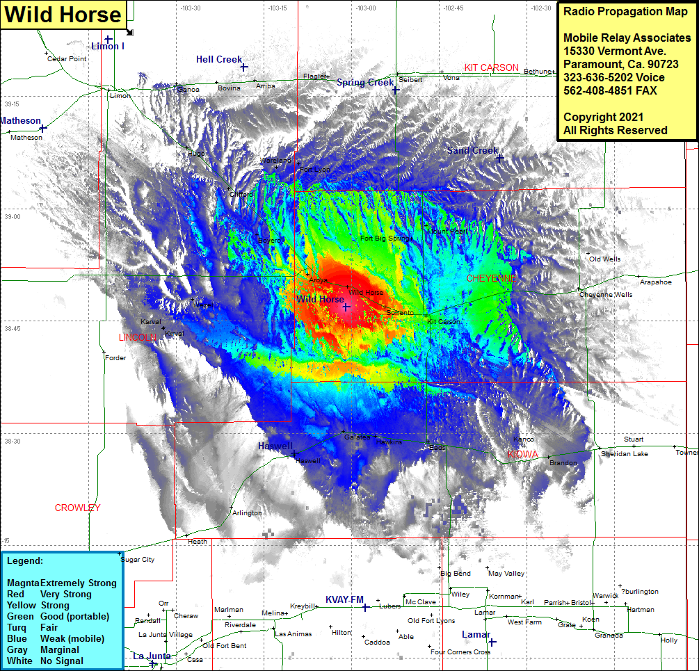 Wild Horse II Coverage |
| Latitude: | 038 46 52.5N | 38.7812500 |
| Longitude: | 103 01 00.3W | -103.0167500 |
| Feet | Meters | |
| Ground Elevation: | 4585.0 | 1397.5 |
| HAAT: | 259.6 | 79.1 |
| City: | Cheyenne Wells | |
| County: | Cheyenne | |
| State: | Colorado |
This is not an MRA Owned Site. For space rental contact the site owner.
Do you own or manage this site? Click Here
Would you like to add a site to the Google Earth Map?? Click Here
Site Coverage: Coverage of Wild Horse, Fort Big Spring, Mount Pearl, Seibert, Vona, Cheyenne Wells, Kit Carson, Sorrento, Eads, Kanco, Brandon, Hawkins, Galatea, Haswell, Arlington, Karval, Wezel, Aroya, Boyero, Clifford, Hugo, Genoa, Bovina, Arriba, Wareland, Fort Lyon, Flagler