Black Mesa
| Site Name: | Black Mesa | 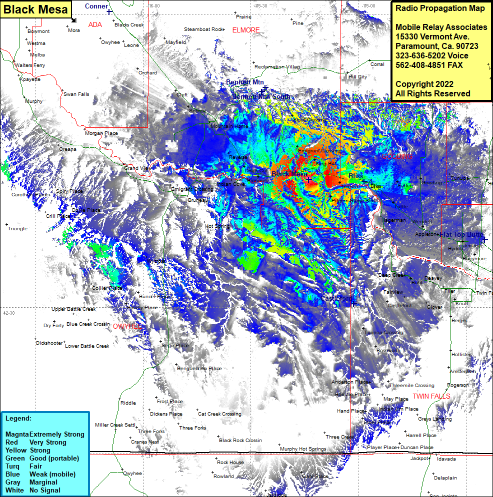 Black Mesa Coverage |
| Latitude: | 042 56 13.0N | 42.9369444 |
| Longitude: | 115 13 53.5W | -115.2315278 |
| Feet | Meters | |
| Ground Elevation: | 3084.0 | 940.0 |
| HAAT: | 233.6 | 71.2 |
| City: | Hammett | |
| County: | Elmore | |
| State: | Idaho |
This is not an MRA Owned Site. For space rental contact the site owner.
Do you own or manage this site? Click Here
Would you like to add a site to the Google Earth Map?? Click Here
Site Coverage: Coverage of most of Gooding County, southern Elmore County, Emigrant Crossing, King Hill, Stout Crossing, Ticeska, Pilgrim Stage Station, Bliss, Fuller, Gooding, Tunupa, Shoshone, Tuttle, Wendell, Hagerman, Appleton, Hydra, Herome, Barrymore, Knull, Filer, Peavey, Cedar, Buhl, Clover, Berger, Deep Creek, Fairview, Castleford, Clover, Tuanna Crossing, Roseworth, Anderson, Hot Springs, Hot Spring, Wycross, Collier, Bruneau, Emigrant Crossing, Indian Cove, Grand View, Orchard, Cleft, Sebree, Mountain Home, Reverse, Chalk Cut