Black Mtn VII
| Site Name: | Black Mtn VII | 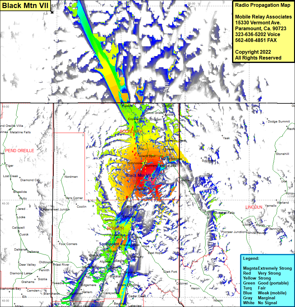 Black Mtn VII Coverage |
| Latitude: | 048 36 37.3N | 48.6103611 |
| Longitude: | 116 15 27.1W | -116.2575278 |
| Feet | Meters | |
| Ground Elevation: | 6107.0 | 1,861.4 |
| HAAT: | 2,767.5 | 843.5 |
| City: | Naples | |
| County: | Boundary | |
| State: | Idaho |
This is not an MRA Owned Site. For space rental contact the site owner.
Do you own or manage this site? Click Here
Would you like to add a site to the Google Earth Map?? Click Here
Site Coverage: Coverage of Bonners Ferry, Schnoors, Allens Spur, Ritz, Moyle Springs, Katka, Eileen, Meadow Creek, Copeland, Perhill, Good Grief, Addie, Eastport, Elmira, Samuels, Colburn, Sandpoint, Kootenai, Oden, Dover, Sagle, Dufort, Laclede, Sawyer, Chilco, North Pole, Athol, Spirit Lakes, Edgemere, Vay, Sawyer