Bliss
| Site Name: | Bliss | 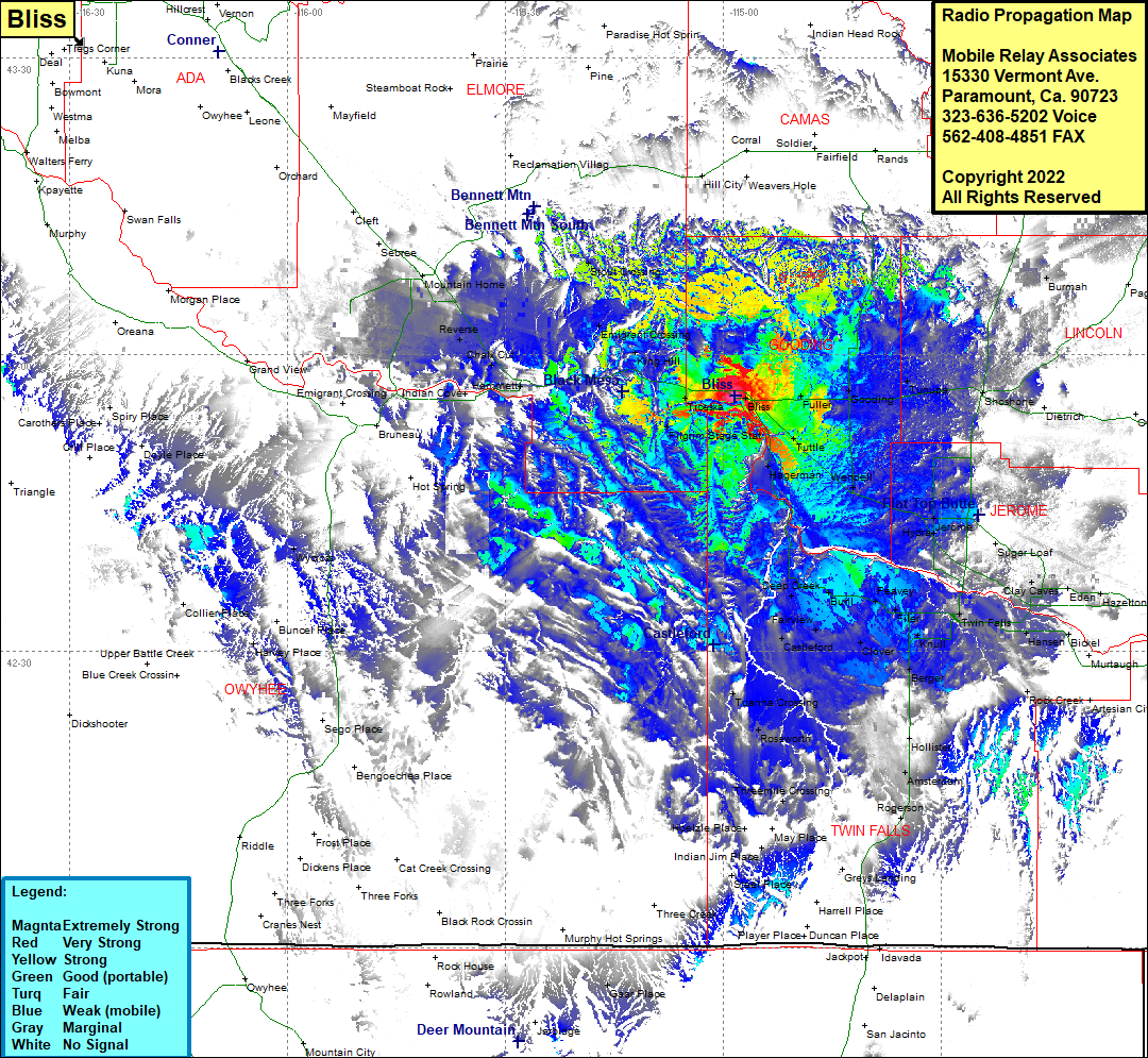 Bliss Coverage |
| Latitude: | 042 55 46.1N | 42.9294722 |
| Longitude: | 114 58 29.6W | -114.9748889 |
| Feet | Meters | |
| Ground Elevation: | 3294.0 | 1,004.0 |
| HAAT: | 96.1 | 29.3 |
| City: | Bliss | |
| County: | Gooding | |
| State: | Idaho |
This is not an MRA Owned Site. For space rental contact the site owner.
Do you own or manage this site? Click Here
Would you like to add a site to the Google Earth Map?? Click Here
Site Coverage: Coverage of Burmah, Bliss, Fuller, Gooding, Tunupa, Shoshone, Tuttle, Wendell, Appleton, Hydra, Herome, Barrymore, Hagerman, Deep Creek, Buhl, Peavey, Filer, Knull, Twin Falls, Clay Caves, Eden, Bills, Hansen, Berger, Clover, Castleford, Fairview, Tuanna Crossing, Roseworth, Amsterdan, Anderson Place, Wycross, Harvey Place, Bruneau, Emigrant Crossing, Indian Cove, Hammett, Chalk Cut, Reverse, Mountain Home, King Hill, Emigrant Crossing, Stout Crossing