Boneville Peak
| Site Name: | Boneville Peak | 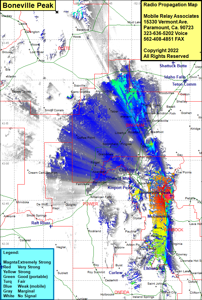 Boneville Peak Coverage |
| Latitude: | 042 46 41.9N | 42.7783056 |
| Longitude: | 112 09 44.6W | -112.1623889 |
| Feet | Meters | |
| Ground Elevation: | 6500.0 | 1,981.2 |
| HAAT: | 578.8 | 176.4 |
| City: | McCammon | |
| County: | Bannock | |
| State: | Idaho |
This is not an MRA Owned Site. For space rental contact the site owner.
Do you own or manage this site? Click Here
Would you like to add a site to the Google Earth Map?? Click Here
Site Coverage: Coverage of Pocatello, Crystal, Virginia, Robin, Hawkins, Swan Lake, Daniels, Dairy Creek, Interstate 15 south to Virginal and north to Blackfoot, Bannock, Schiller, Michaud, American Falls, Fairview, Aberdeen, Fingal, Grandview, Springfield, Pingree, Liberty, Rockford, Aiken Moreland, Rouse, Olsen, Taber, McDonaldville, Rising River, Coffee Point, Idaho Highway 39 from Aiken to American Falls, Lone Rock