Castleford
| Site Name: | Castleford | 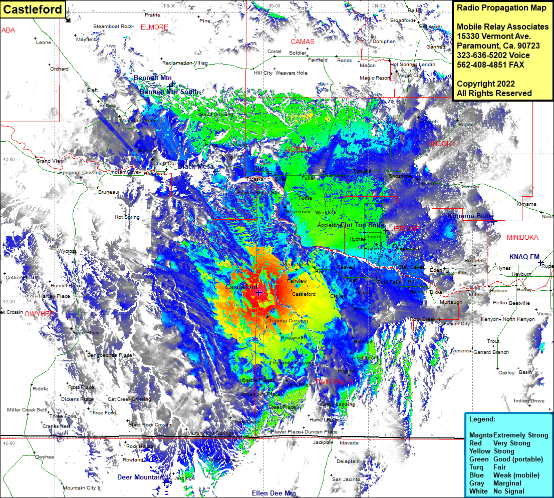 Castleford Coverage |
| Latitude: | 042 30 41.2N | 42.5114444 |
| Longitude: | 115 01 23.9W | -115.0233056 |
| Feet | Meters | |
| Ground Elevation: | 4419.0 | 1,346.9 |
| HAAT: | 388.3 | 118.3 |
| City: | Buhl | |
| County: | Twin Falls | |
| State: | Idaho |
This is not an MRA Owned Site. For space rental contact the site owner.
Do you own or manage this site? Click Here
Would you like to add a site to the Google Earth Map?? Click Here
Site Coverage: Coverage of Castleford, Ticeska, Bliss, Fuller, Tuttle, Wendell, Hagerman, Gooding, Tunupa, Shoshone, Dietrich, Basslen, Owinza, Burmah, Magic Resort, Magic City, Tikura, Pagari, Appleton, Hydra, Jerome, Barrymore, Sugar Loaf, Hunt, Clay Caves, Eden, Hazelton, Schodde, Milner, Bickel, Artesian City, Twin Falls, Knull, Filer, Peavey, Buhl, Deep Creek, Fairview, Clover, Berger, Tuanna Crossing, Roseworth, Hollister, Amsterdam, Rogerson, Rock Creek, Threemile Crossing, May Place, Steel Place, Indian Jim Place, Hoelzle Place, Anderson Place, Greys Landing, Harrell Place, Emigrant Crossing, Chalk Cut, Reverse, Stout Crossing