Conner
| Site Name: | Conner | 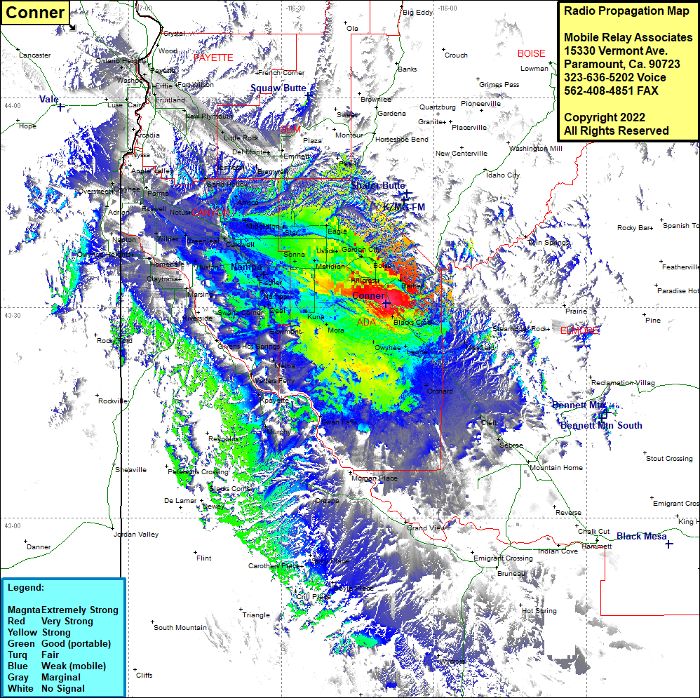 Conner Coverage |
| Latitude: | 043 30 35.6N | 43.5098889 |
| Longitude: | 116 09 28.3W | -116.1578611 |
| Feet | Meters | |
| Ground Elevation: | 3290.0 | 1,002.8 |
| HAAT: | 95.3 | 29.1 |
| City: | Hillcrest | |
| County: | Ada | |
| State: | Idaho |
This is not an MRA Owned Site. For space rental contact the site owner.
Do you own or manage this site? Click Here
Would you like to add a site to the Google Earth Map?? Click Here
Site Coverage: Coverage of Hillcrest, Barbel, Boise, Garden City, Boise Junction, Perkins, Pleasant Valley, Owyhee, Highlands, Twin Spings, Mayfield, Regina, Leone, Orchard, Cleft, Sebrae, Swan Falls, Murphy, Kayette, Walters Ferry, Melba, Westma, Bowmont, Mora, Kuna, Nampa, Deal, Kings Corner, Fischer, Sonna, Meridian, Ustick, Perkins, Vernon, Midway, Maddens, Caldwell, Underkoflers Corner, Greenleaf, Enrose, Notus, Amsco, Sand Hollow, Rookstool Corner, Parma, Roswell, Overstreet, Owyhee, Nyssa, Arcadia, Washoe, Fruitland, Fort Wilson, New Plymouth, Little Rock, Jenness, Bramwell, Del Monte, Emmett, Black Canyon, Middleton, Amsco, Sand Hollow, Star, Eaglt, Pearl