Curlew
| Site Name: | Curlew | 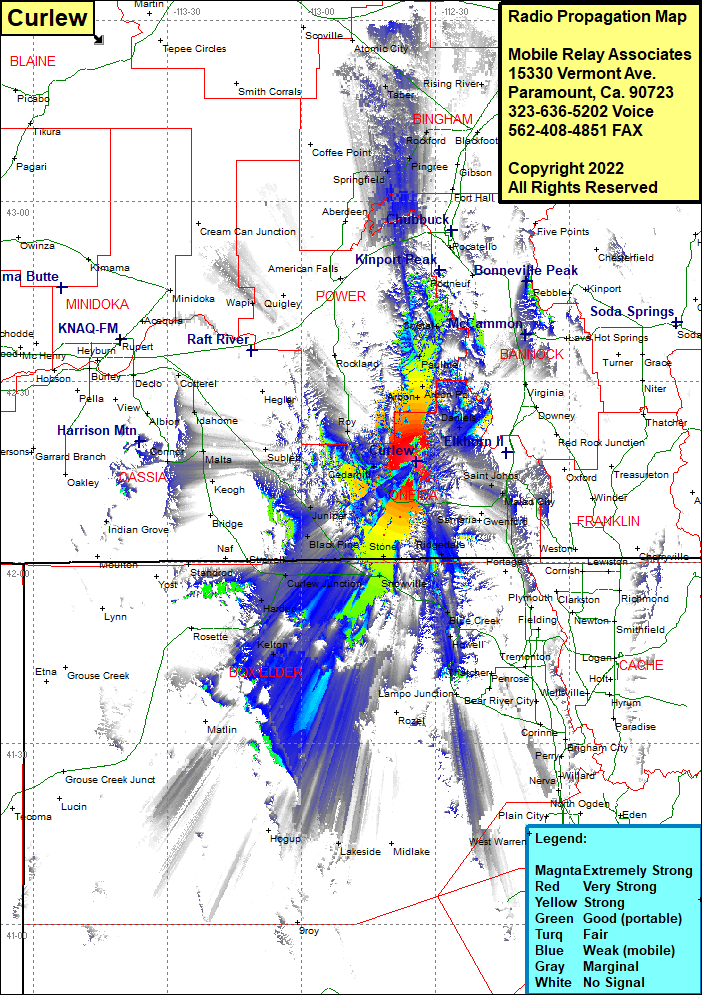 Curlew Coverage |
| Latitude: | 042 16 45.4N | 42.2792778 |
| Longitude: | 112 34 19.5W | -112.5720833 |
| Feet | Meters | |
| Ground Elevation: | 6673.0 | 2,033.9 |
| HAAT: | 1,099.3 | 335.1 |
| City: | Cedarhill | |
| County: | Oneida | |
| State: | Idaho |
This is not an MRA Owned Site. For space rental contact the site owner.
Do you own or manage this site? Click Here
Would you like to add a site to the Google Earth Map?? Click Here
Site Coverage: Coverage of Buist, Arbon, Arbon PO, Pauline, Crystal, Hawkins, Dairy Creek, Daniels, Robin, Saint Johns, Malad City, Cherry Creek, Woodruff, Gwenford, Holbrook Summit, Samaria, Ridgedale, Washakie, Stone, Snowville, Blue Creek, Howell, Kelton, Hardup, Cedar Creek, Curlew Junction, Black Pine, Holbrook, Cedarhill, Juniper, Black Pine, Sublette, Roy Summit, Roy, Keogh, Malta, Idahome, Cotteral, Connor