Flat Top Butte
| Site Name: | Flat Top Butte | 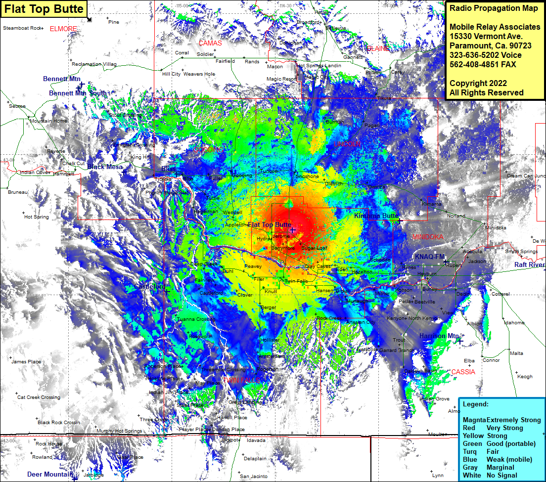 Flat Top Butte Coverage |
| Latitude: | 042 43 47.2N | 42.7297778 |
| Longitude: | 114 24 55.3W | -114.4153611 |
| Feet | Meters | |
| Ground Elevation: | 4306.0 | 1,312.5 |
| HAAT: | 527.4 | 160.7 |
| City: | Jerome | |
| County: | Jerome | |
| State: | Idaho |
This is not an MRA Owned Site. For space rental contact the site owner.
Do you own or manage this site? Click Here
Would you like to add a site to the Google Earth Map?? Click Here
Site Coverage: Coverage of Shoshone, Magic Resort, Magic City, Hot Springs Landing, Burmah, Pagan, Tilura, Carey, Cream Can Junction, Minidoka, Norland, Kimama, Owinza, Dietrich, Acequia, Rupert, Budge, Hynes, Schodde, Hazelton, Eden, Clay Caves, Sugar Loaf, Barrymore, Jerome, Hydra, Twin Falls, Bills, Hansen, Brickel, Murlaugh, Milner, Hobson, Burley, Pella, Beetville, View, Declo, North Kenyon, Artesian City, Trout, Iversons, Garrard Branch, Oakley, Artesian City, Rock Creek, Hansen, Bills, Twin Falls, Knull, Berger, Hollister, Amsterdam, Rogerson, Clover, Harrell Place, Duncan Place, Player Place, Steel Place, Indian Jim Place, May Place, Hoelzle Place, Anderson Place, Threemile Crossing, Roseworth, Tuanna Crossing, Clover, Castleford, Fairview, Buhl, Deep Creek, Peavey, Filer, Fairview, Hagerman, Wendell, Tuttle, Pilgrim State Station, Ticeska, Bliss, Fuller, Gooding, Tunepa, Emigrant Crossing