Kelly Mtn
| Site Name: | Kelly Mtn | 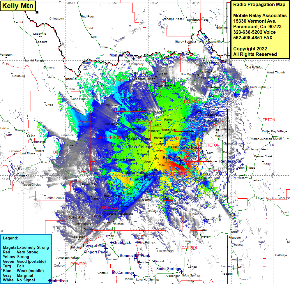 Kelly Mtn Coverage |
| Latitude: | 043 37 44.0N | 43.6288889 |
| Longitude: | 111 36 43.6W | -111.6121111 |
| Feet | Meters | |
| Ground Elevation: | 6800.0 | 2,072.6 |
| HAAT: | 1,104.0 | 336.5 |
| City: | Byrne | |
| County: | Madison | |
| State: | Idaho |
This is not an MRA Owned Site. For space rental contact the site owner.
Do you own or manage this site? Click Here
Would you like to add a site to the Google Earth Map?? Click Here
Site Coverage: Coverage of Poplar, Swan Valley, Irwin, Palisades, Alpine, Keenan City, Guyaz, Dehlin, Bone, Milo, Ucon, Rigby, Orvin. Iona, Lewisville, Bessett, Payne, Osgood, Woodville, Colton, Shelley, Basalt, Rising River, Goshen Junction Firth, McDonaldville, Blackfoot, Rockford, Gibson, Fort Hall, Pingree, Liberty, Springfield, Grandview, Aberdeen, Coffee Point, Havens, Taber, Atomic City, Cerro Grande, Scoville, Howe, Berenice, Mud Lake, Monteview, Hawgood, Hamer, Camas, Jones Crossing, Dubois, Spencer, Jenkins Will, Eighteenmile, Idmon, Kilgore, Macks Inn PO, Island Park, Box Canyon, Last Chance, Eccles, Pineview, Gerrit, Warm River, Ashton, Chester, Squirrel, Drummond, Judkins, Felt, Ashton, Tetonia, Newdale, Teton, Sugar City, Rexburg, Plano, Edmonds, Herman, Twin Groves, Woods Crossing, Walker, Archer